Monday, May 10, 2004 - Limon, CO area tornadoes
As I made my morning forecast... it appeared that a moist upslope flow of air would become established in eastern Colorado and eastern Wyoming by afternoon. The better shear profiles would be found in Wyoming... while better instability would be found in Colorado. The following day looked good for supercells in the central and northern plains and I had planned on using this day more as a travel day... but with the hope that I would see upslope storms as well. I got off work at 7 a.m. and had a hard time talking myself into the long drive... but ended up leaving around 8:30 a.m.
Looking at data as I approached Goodland, KS... the upslope flow had indeed strengthened... but more to my surprise was the quality of the moisture that was moving as well. Goodland had a 61 dewpoint which I thought seemed really good and Akron, CO had a 55 dewpoint. My initial plan was to split the difference between what I thought was the better shear and the better instability... or basically near the Colorado/Wyoming border. Getting ready to cross over into Colorado... I noticed the first storms on radar in western Elbert and northern El Paso counties. These would be moving toward the good moisture near Akron so I decided to target them and head west southwest.
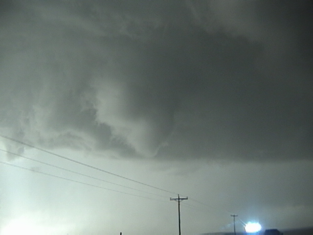
Approaching the storms near Last Chance I found them to be high-based with no well defined updrafts, producing a lot of virga, and generally going downhill on radar. Watching the area farther north I did not see any new development. So, I sat and watched my mess of storms to the southwest. Since north was the direction I wanted to be the next day, I had made the decision to go ahead and start drifting that way. As I was about to leave, a storm at the south end of the “mess” in El Paso county became stronger, isolated from the rest and began giving hail signatures on radar. Since I was within an hour of it I started that way to see what it looked like. At Limon looking southwest... this was a nice looking little storm. It had a lot of lightning, flared updraft base and a couple of low and mid level inflow bands. I drove west and dropped south through the core of the storm finding hail between quarter and golfball size. Here is how the updraft looked driving south toward it. Another view. While I was making this trip south I was watching on radar as storms were coming up from the southwest and looked like they were going to merge with my target storm. This would take place near Ramah. Several years ago I thought it bad when a storm would crash into the one I was chasing. But during the past few years I have been seeing more and more instances where tornado production increased just after the merger. While not always the case... it would be this day. Several areas of strong rotation developed near the town of Ramah and one brief tornado may have occurred just west of the town. This is the first instance on this day of me changing my original thoughts from “tornado” to “no-tornado”. I have not been able to verify that this reached the ground.
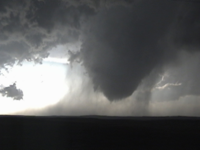
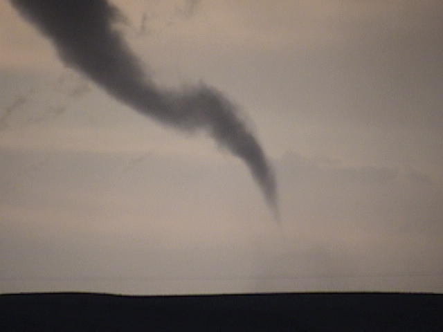
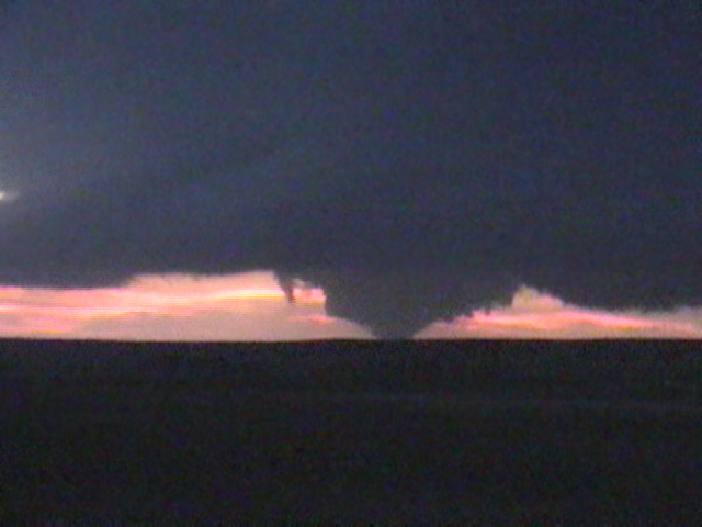
North of Ramah, a new area of rotation had developed and a funnel cloud became evident. Closer views of the video show very strong rotation in wrapping rain below this and thus started tornado number one. A short time later, condensation reached the ground. Here is a view from just east of Ramah... looking back to the northwest. This would evolve into a large truncated cone.
A little over midway through the life of tornado number one.... tornado number two developed just north of me with the new mesocyclone. This tornado was not very impressive and lasted about three minutes.
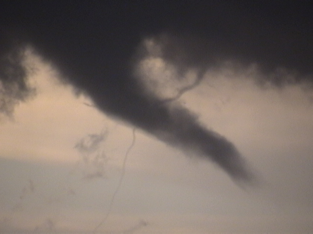
Meanwhile... tornado number one continued to the west. It now had become exposed from the rain and was a rather ugly multiple-vortex tornado. I pulled up just to the east of the new mesocyclone and had this view to the west with the first tornado in the background. The first tornado would be gone soon and my focus was with the new circulation that was moving to my north. Here, my car got rocked with 70+ mph RFD winds that tore down a power line and caused a nice power flash a couple of poles down from me.
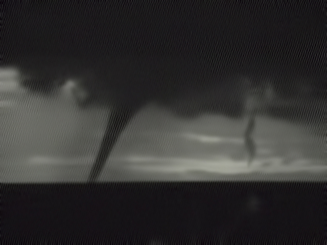
I started eastbound on highway 86 from the road to Simla when tornado number three became visible to the northwest. Another view. Close up. Another view.
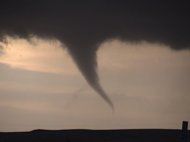
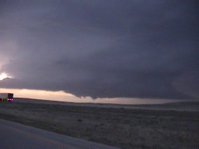
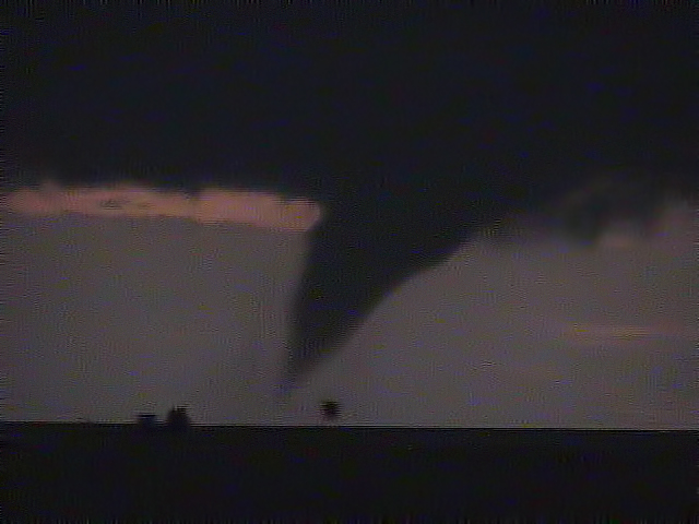
After tornado three weakened... I moved east to I-70 and stopped at a point midway between highway 86 and Limon to look at the beautiful supercell. I had intended to go to Limon to get something for a severe sinus headache and then go north on highway 71 to intercept the storm. Before I could get rolling... tornado number four developed to the northwest. Another view. Closer view. I’ve been seeing some interesting cloud motions during the past few chases. With this tornado... there were several little “stringy” vortices around it. This tornado lasted about six minutes.
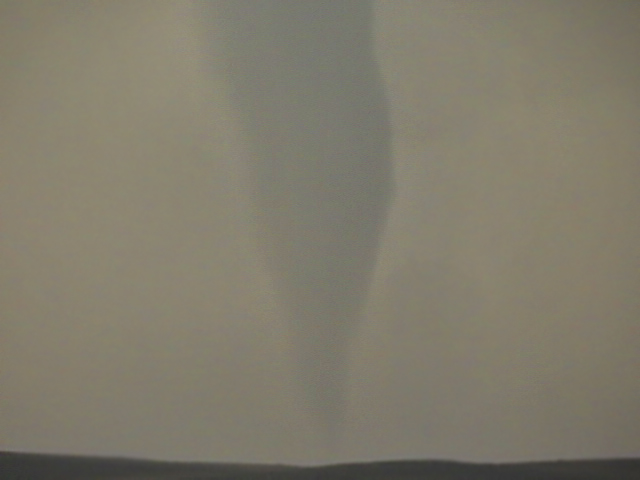
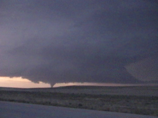
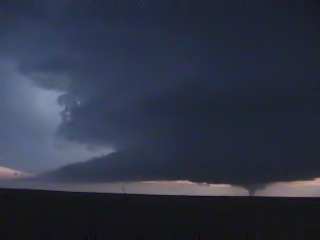
Not long after number four weakened.... a very large and strongly rotating wall cloud developed. While no debris was evident... cloud motion at this time suggested that tornado number five was on the ground. It evolved into a nice cone tornado just a minute or so later. Closer view. I can’t get enough of great structure and here is another amazing image. Finally getting northbound out of Limon on highway 71....the large cone tornado was still on the ground to the west. Getting darker... I changed exposures on my video camera as the tornado became a “near-wedge”. A few minutes later, it continues to get dark and the strong tornado continues.
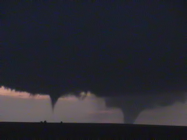
A new mesocyclone developed between me and tornado number five and tornado number six rapidly formed. Another view. A closer view of the new tornado. I switched the camera to “nightshot” and got this view of the storm structure and both tornadoes five and six. A closer view of tornado six. Here, tornado number five is roping out while tornado six is starting to weaken somewhat. Both tornadoes would be gone soon after.
Before it was over, the storm would produce again. This time it would be another large tornado near the north side of the updraft. It was very dark at this time and I only got a couple of minutes video of this tornado. That would be the last I saw with this very impressive storm that gave me seven tornadoes and one hour 48 minutes of tornado time.
From my logs and video... here are my “best guesses” of the tornadoes. I did no damage survey.
Number one... 633 pm to 658 pm MDT... Elbert county... 1 N Ramah to 10 N Ramah... 9 miles long... up to 200 yards wide *looked high end weak or low end strong*
Number two... 649 pm to 652 pm MDT... Elbert county... 4 NNW Simla to 6 NNW Simla... 2 miles long... 50 yards wide *looked weak*
Number three... 704 pm to 725 pm MDT... Elbert county... 9 N Simla to 10 SW Agate... 6 miles long... up to 150 yards wide *looked high end weak or low end strong*
Number four... 749 pm to 755 pm MDT... Elbert county... 4 S Agate to 5 S Agate... short and narrow *looked weak*
Number five... 759 pm to 829 pm MDT... Elbert county... 4 SSE Agate to 7 ENE Agate... 8 miles long... up to 500 yards wide *looked high end strong or low end violent*
Number six... 821 pm to 833 pm MDT...Elbert county... 13 NW Limon to 14 NNW Limon... 4 miles long... up to 150 yards wide *looked strong*
Number seven... 838 pm to 849 pm MDT... Elbert and Lincoln counties... 13 NNW Limon to 15 N Limon... 3 miles long... up to 150 yards wide *looked strong*