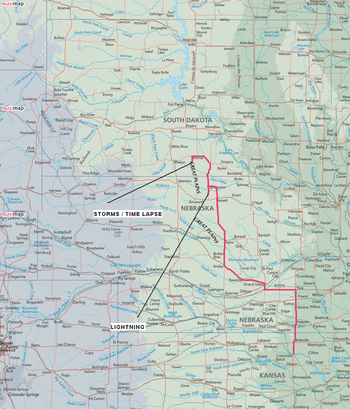
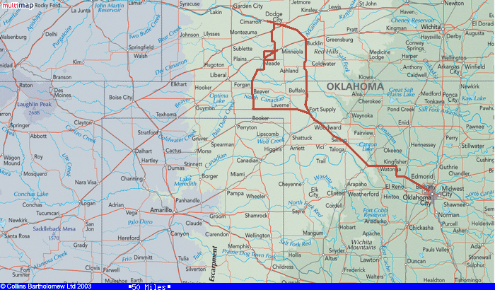
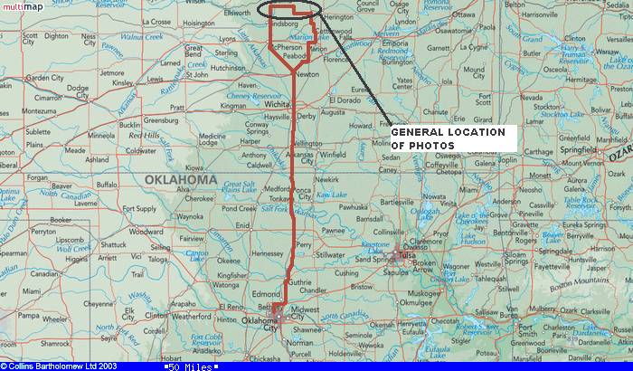
2007 Storm Chase Season
Chase days: 28
Number of days with tornadoes: 6
Observed tornadoes: 12
* Fuel costs *
Total spent on fuel: $2151.86
Average fuel cost per chase: $76.85
Average fuel cost per tornado: $179.32
Miles: 17,047
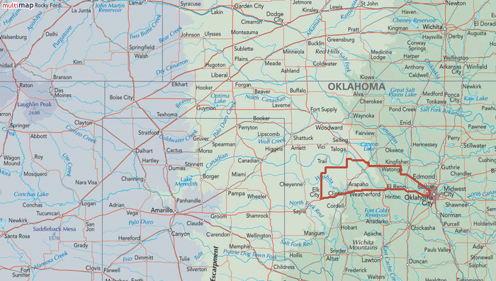
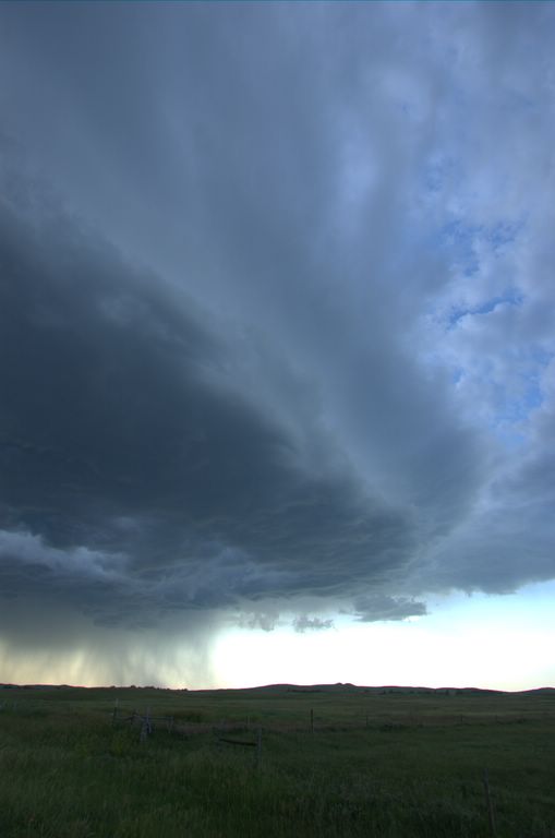
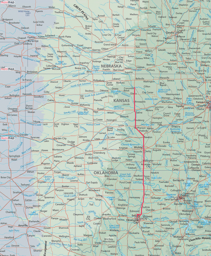
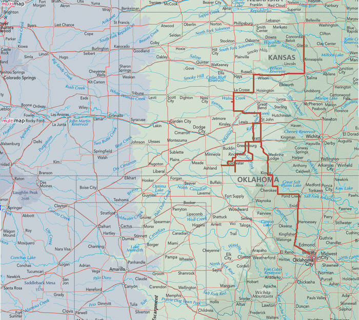
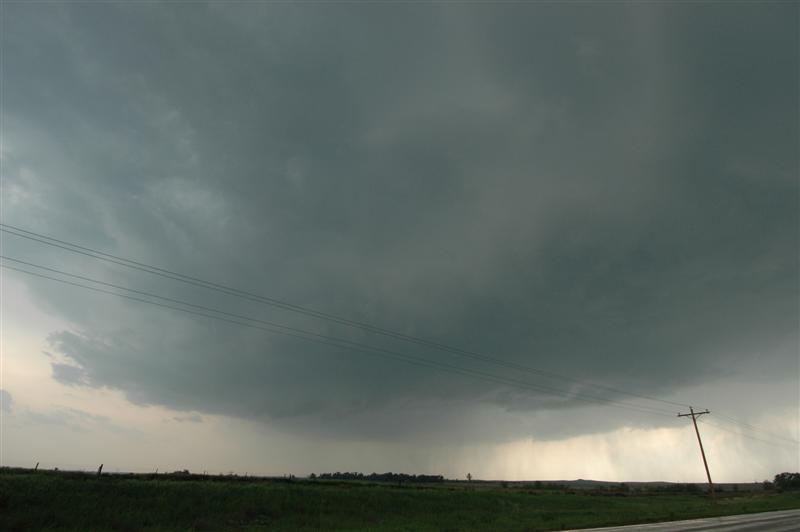
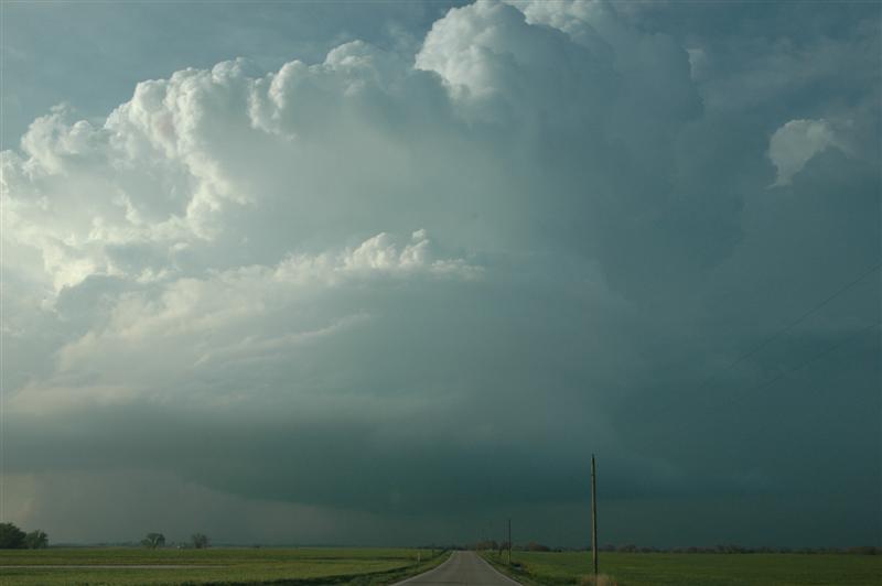
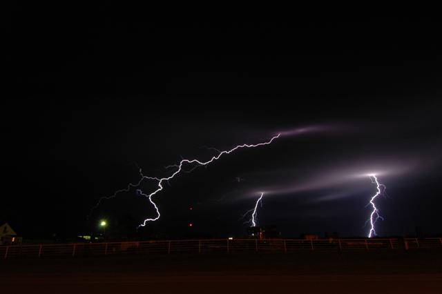
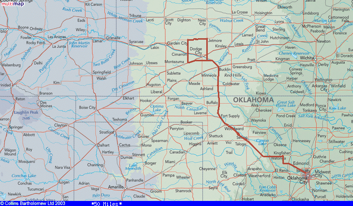
June 18 - 2:53 p.m. - 8:19 p.m. CDT (5 hrs 26 min) 11642-11914 (272 miles) (DS) MAP
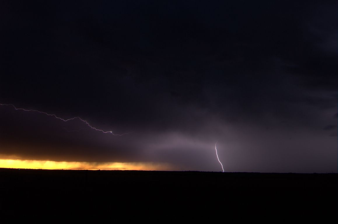
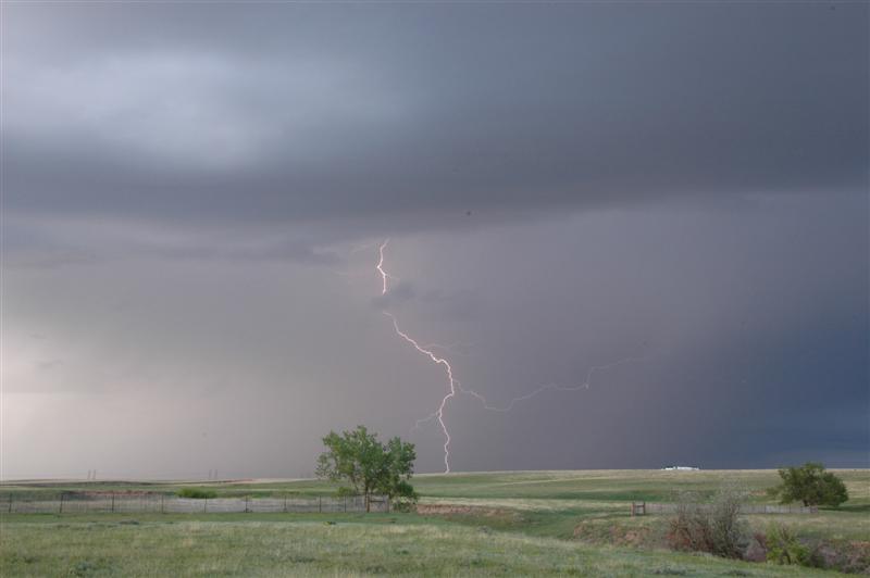
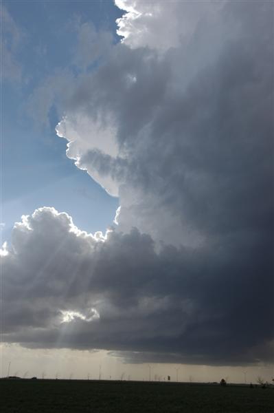
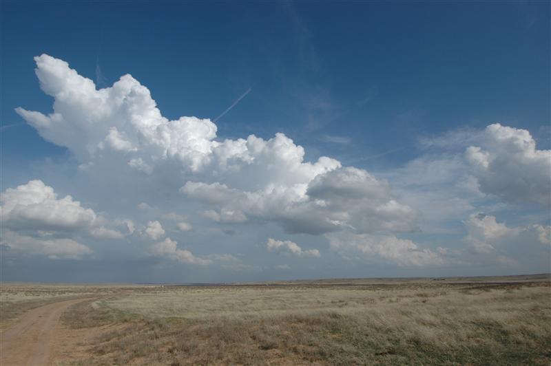
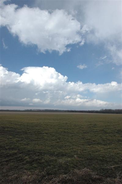
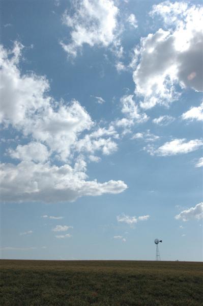
Well... given how this season ended... this chase was fitting. The atmosphere over western Oklahoma was extremely unstable and mostly uncapped... but it appeared that sinking air behind the shortwave in eastern Oklahoma was sufficient to suppress thunderstorm development. We drove to Elk City and then worked our way back along some roads that we don’t usually travel - seeing all the hot spots of Moorewood, Rhea, Burmah and Eagle City.
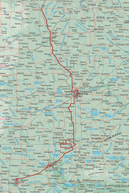
Tour 2 June 13 - 11:38 a.m. - 11:30 p.m. CDT (11 hrs 52 min) 10909-11505 (596 miles) (GP LE) MAP
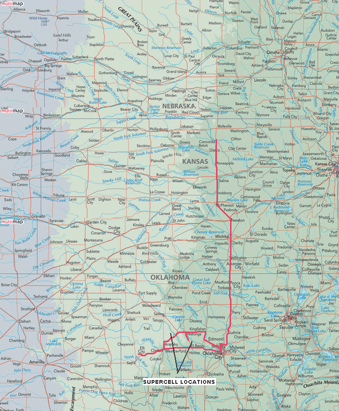
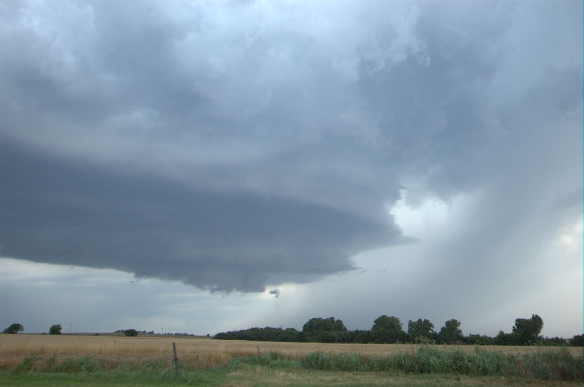
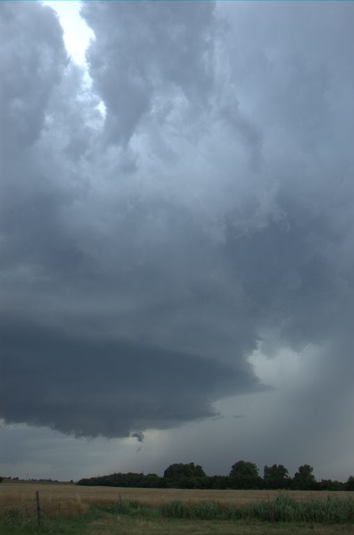
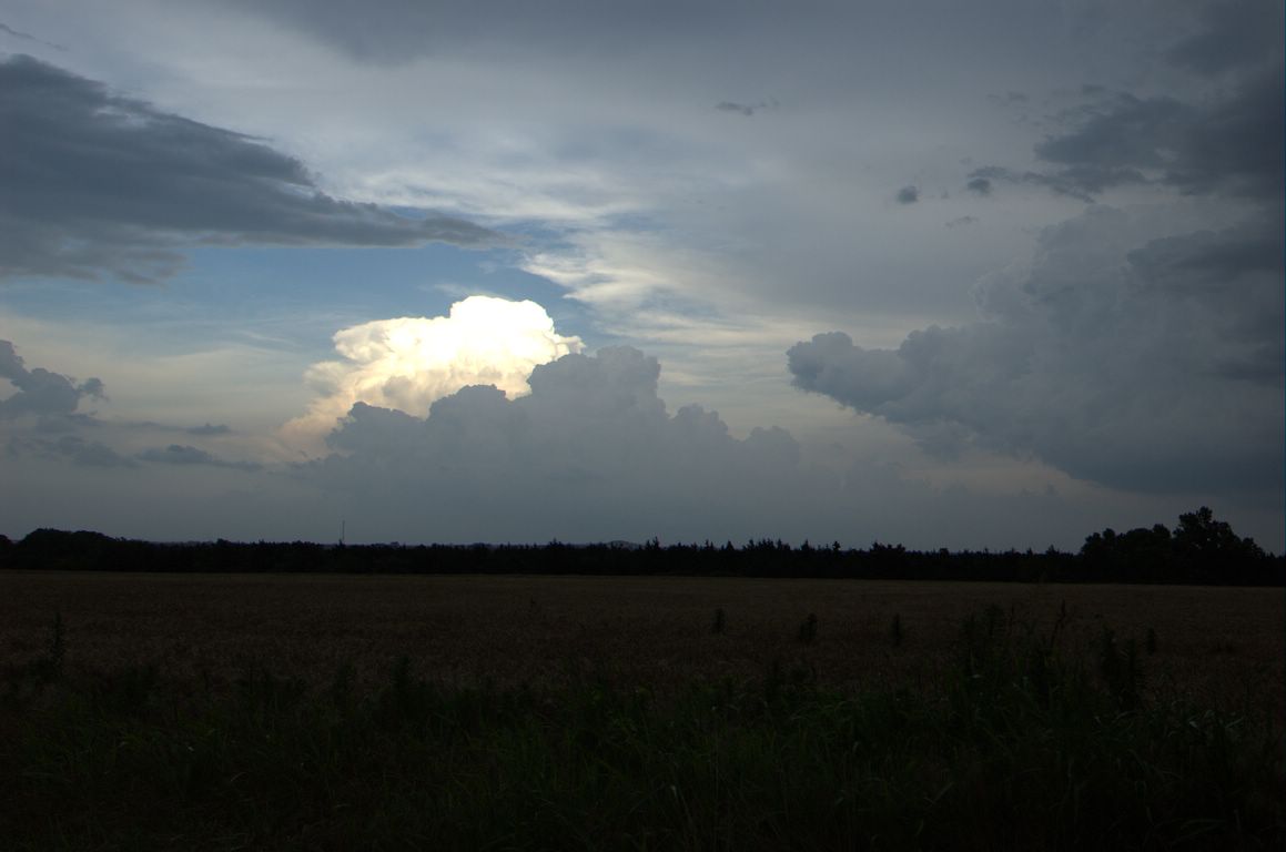
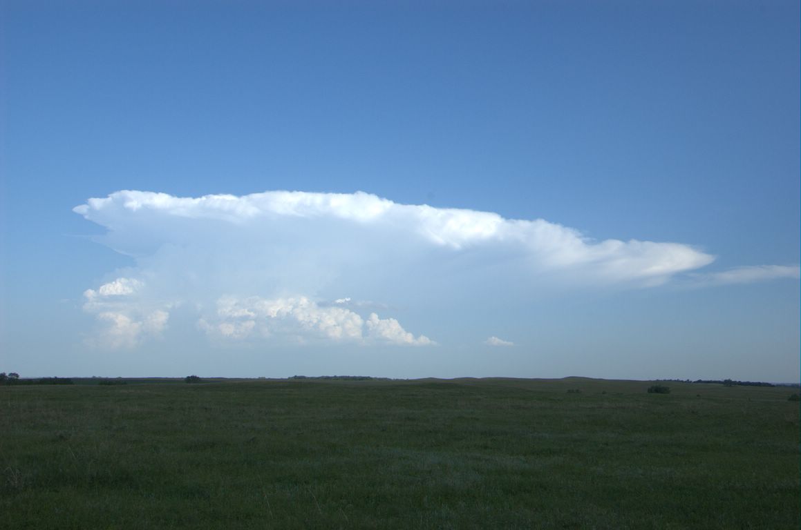
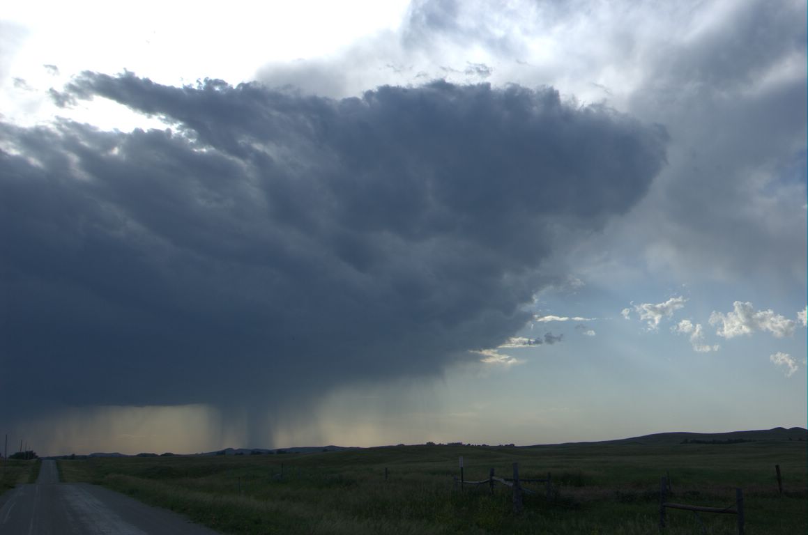
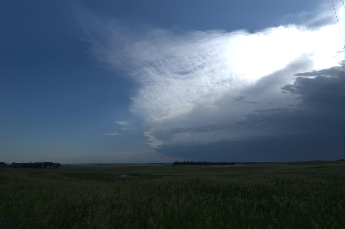
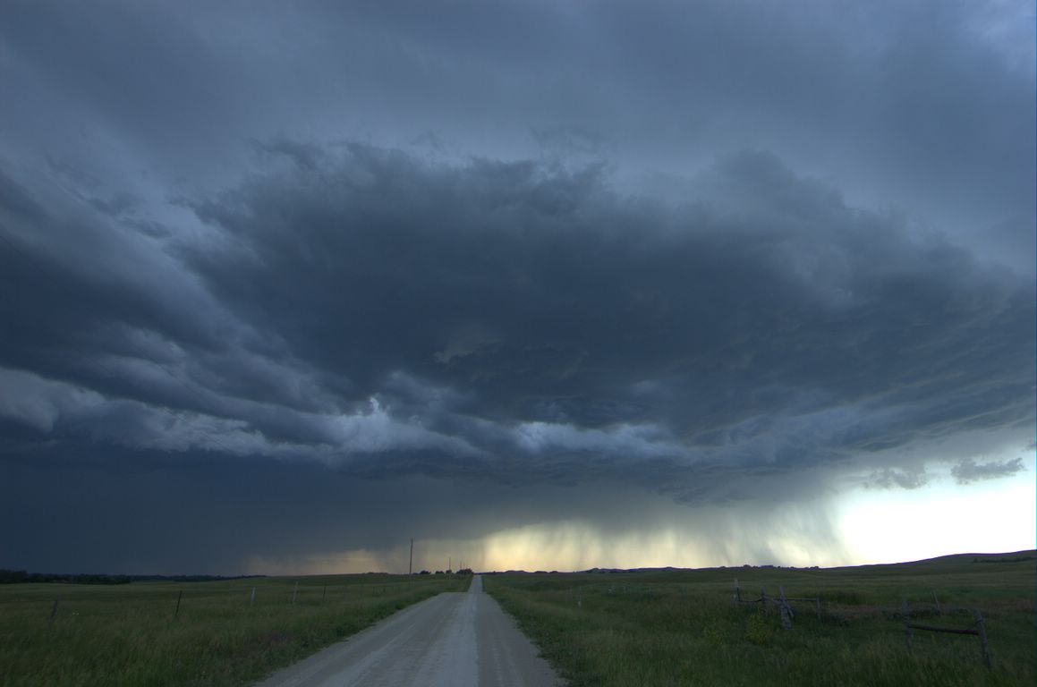
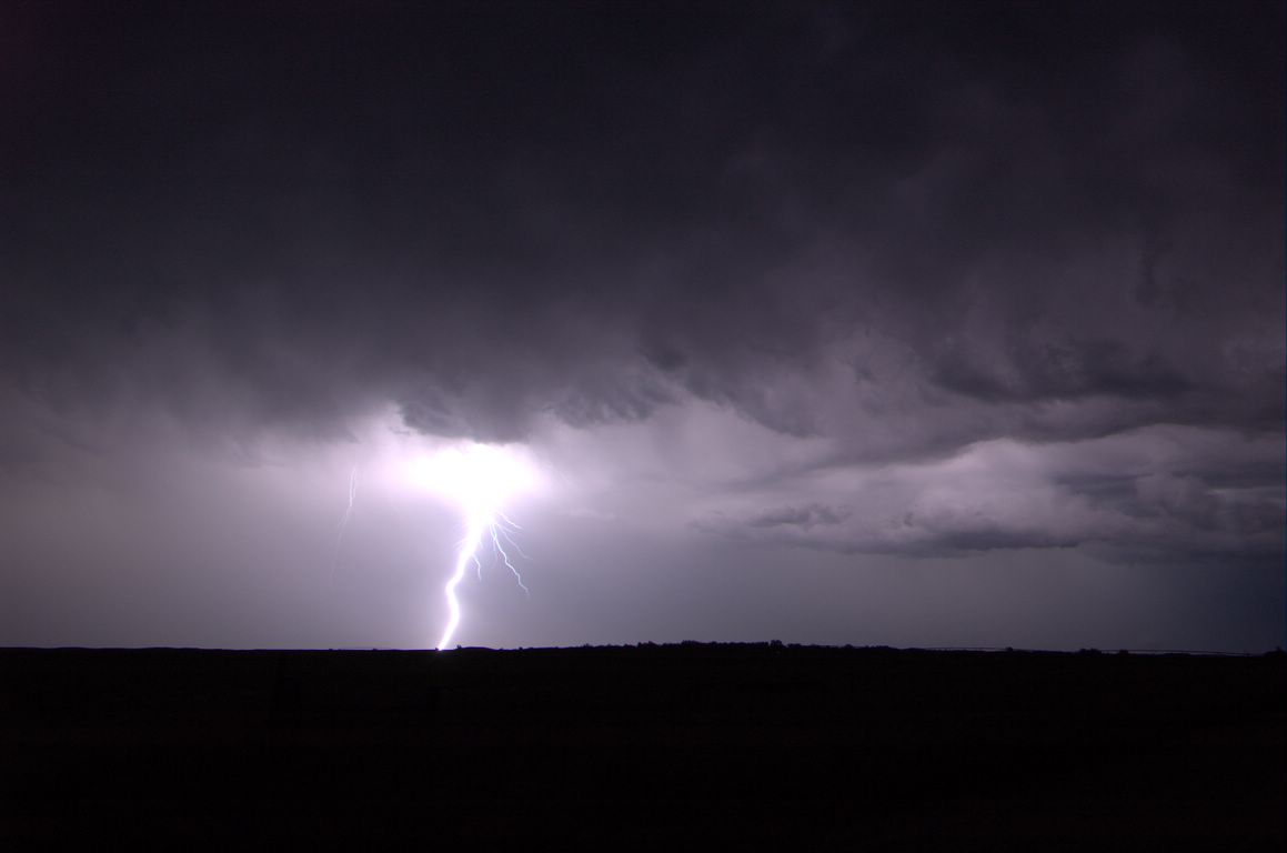
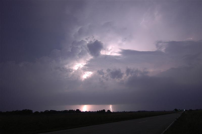
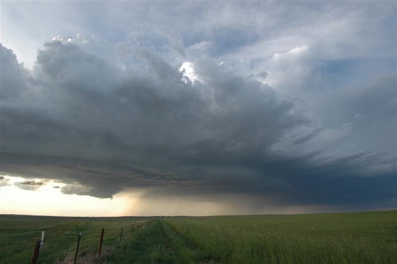
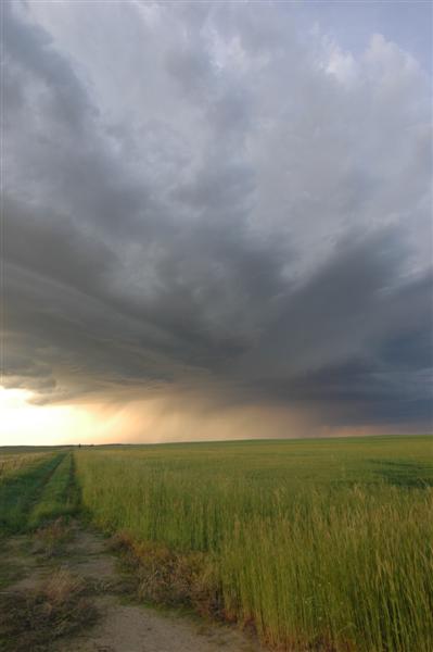
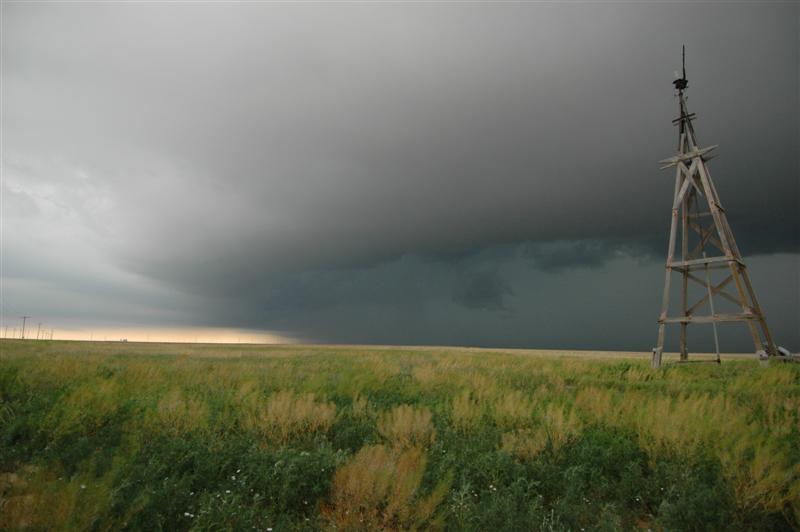
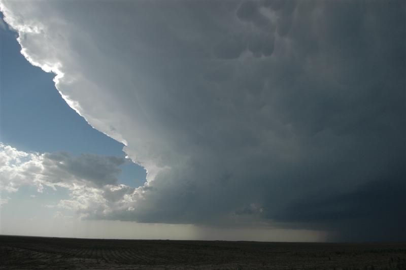
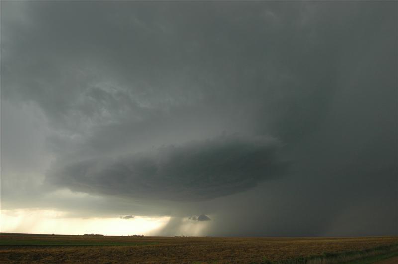
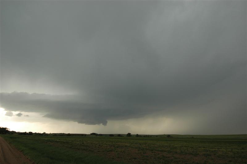
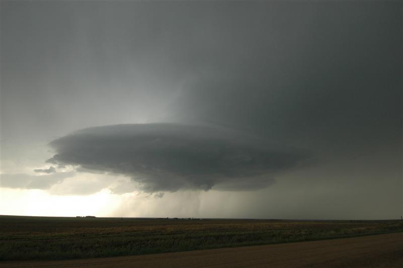
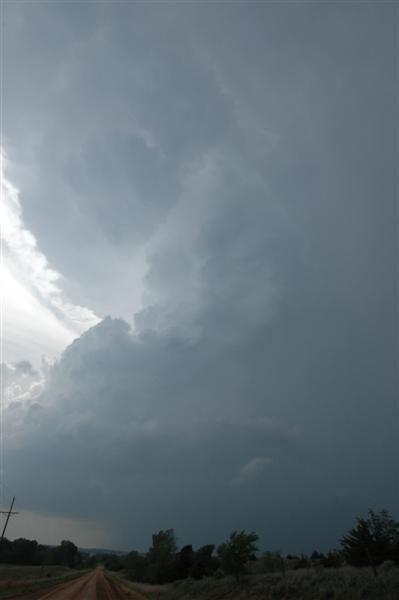
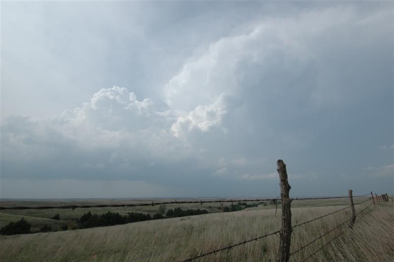
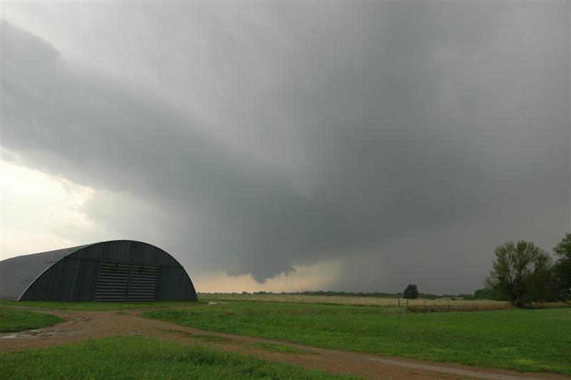
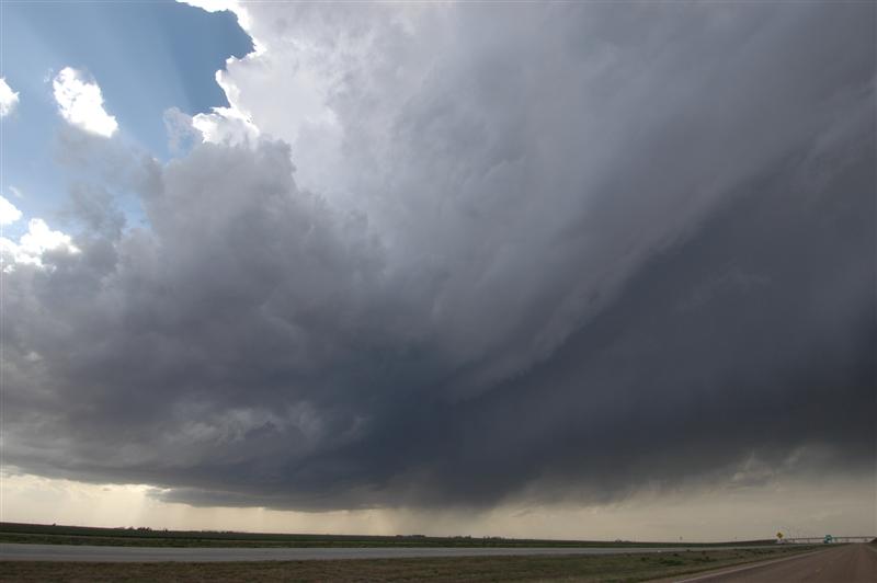
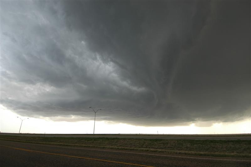
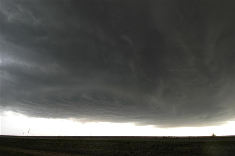
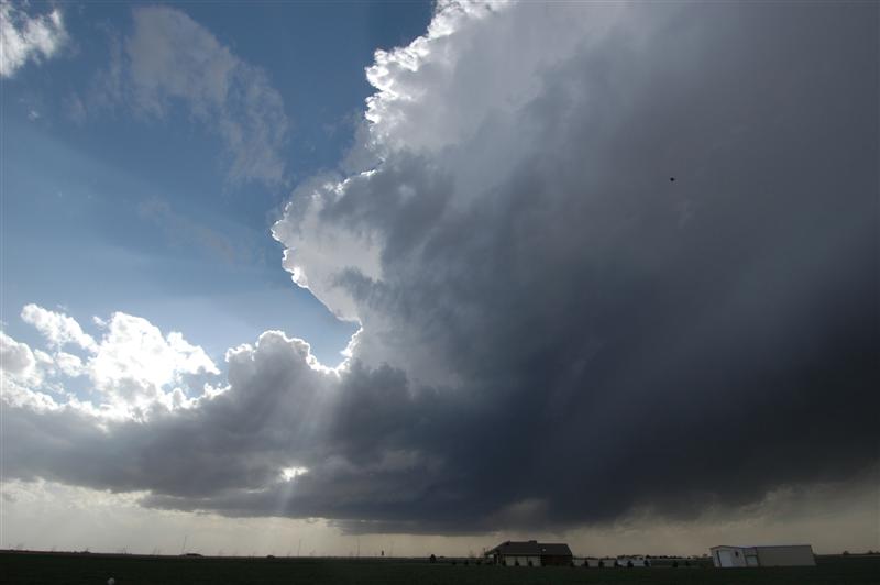
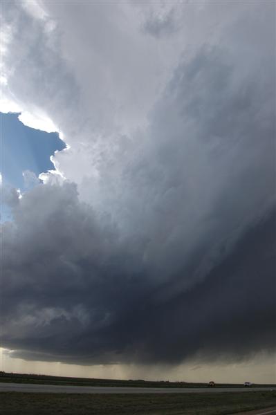
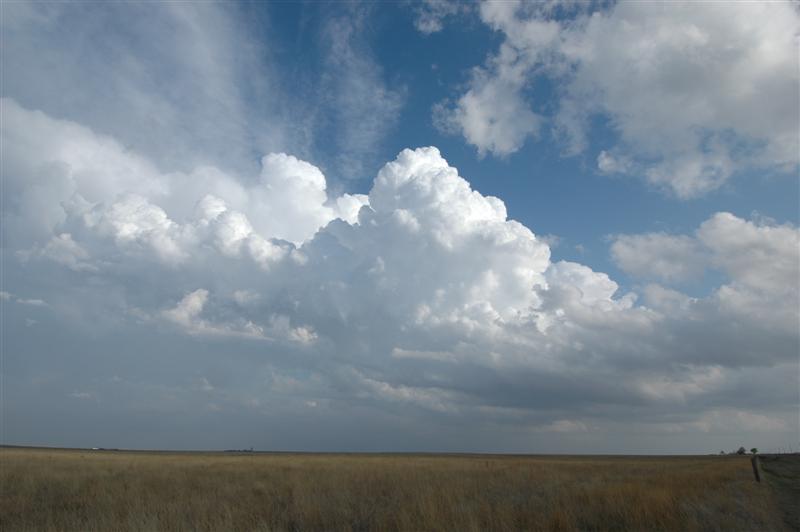
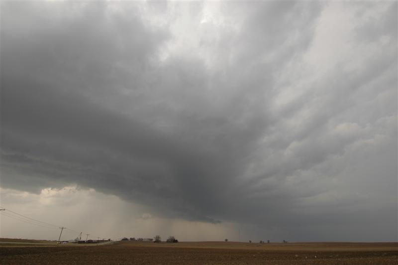
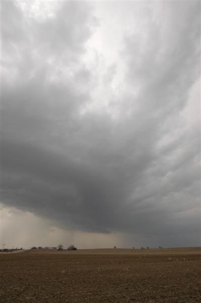
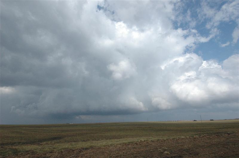
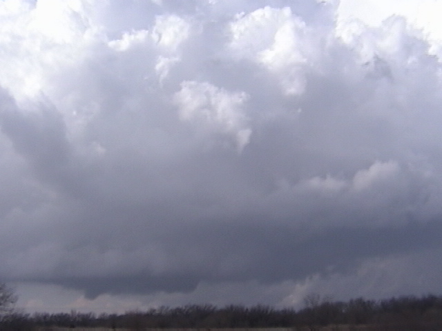
Wouldn’t you know it... our best day came on our last chase day and right in our own backyard. It took a little while to get to the target since we left from Concordia, KS - but our target of western Oklahoma finally worked itself out. The first storms we sampled near Elk City were moisture starved with ugly looking updrafts. There was some nice lightning at times but nothing that made daytime shots worth attempting. Lorraine finally got her picture of a cow and for a time it looked like that would be the only shot of the day. Then things started getting interesting. we jumped on a storm that was forming north of Clinton and followed it to near Thomas. The storm rapidly evolved into a beautiful little supercell (ONE TWO) that had a steadily lowering updraft region as it approached the higher dewpoints toward the middle of the state. The only problem was a quick moving high-precipitation storm that crashed into our target storm. The interaction at first was very interesting. As the gust front of the approaching storm wrapped into the meso-cyclone region of our storm... it produced a strongly rotating wall cloud with cloud fragments about two-thirds of the way to the ground. It appeared that a tornado would quickly form...but the speed of the approaching storm was too quick and rapidly ingested our supercell. The HP storm looked very mean visually and on radar and we quickly slid out of the way of it and into Watonga. From there... we moved south to near Geary where an isolated supercell storm had been moving very slowly northward through northwest Canadian County. This storm also had very nice looking structure and a wall cloud feature about one-half way to the ground Rising motion and rotation was moderate at times and more than once I thought that a tornado would be possible. The life of this storm would eventually be cut short east of Watonga after being caught up in yet more eastward moving convection. We took a few hailstones about quarter size sliding along the southern side of the updraft before finally calling it a night near Okarche. While no tornadoes were seen - the storm ended up giving us a very nice show.
Tour 2 June 12 - 10:35 a.m. - 11:58 p.m. CDT (13 hrs 23 min) 10343-10909 (566 miles) (GP LE) MAP
Little in the way of cap and limited turning with height resulted in a broad area of storms and rain from Nebraska to North Dakota. While we passed several cores... lightning and structure was not impressive. This was used mostly as a travel day and we ended the evening in Concordia, KS.
Tour 2 June 11 - 10:33 a.m. - 10:43 p.m. CDT (12 hrs 10 min) 9788-10343 (555 miles) (GP LE) MAP
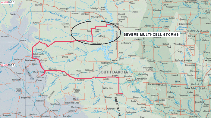
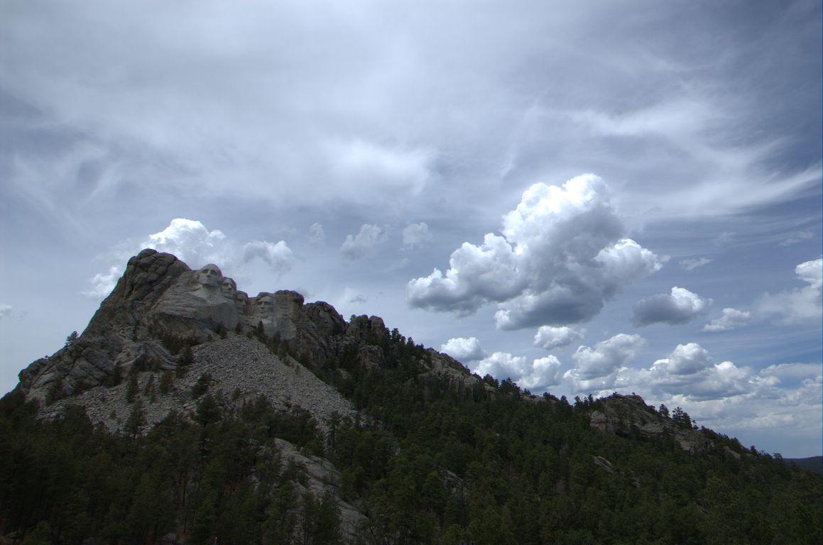
We overnighted in Winner, SD and hit the road this morning to I-90. From there we drove west to Rapid City. Doing pretty good on time... we decided to go by Mount Rushmore. The circus atmosphere that leads up to the park is enough to make you sick...but if you can get there and find an out of the way spot... the view is rewarding. By the time we came down out of the hills... storms had began to form northwest of Belle Fourche. These would be short lived and our attention turned to other storms that had formed and became severe southwest of Faith. We have become used to storms quickly becoming outflow unbalanced and this day would be no different as our elevated and windy convection rolled toward Mobridge. While we did get a few stabs at daytime lightning... the storms shut off the electricity at sunset.
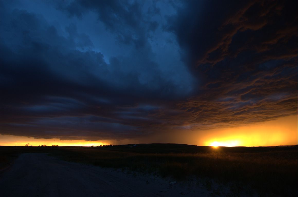
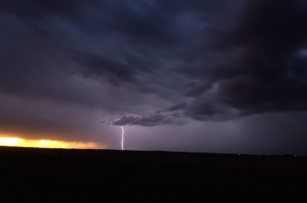
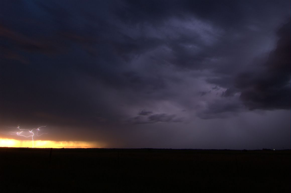
Tour 2 June 10 - 10:47 a.m. - 12:35 a.m. CDT (13 hrs 48 min) 9260-9788 (528 miles) (GP LE) MAP
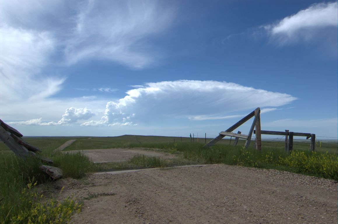
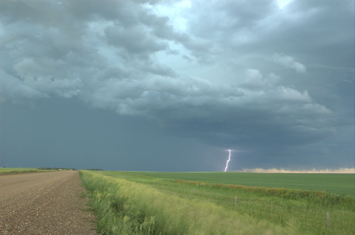
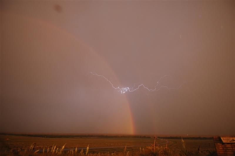
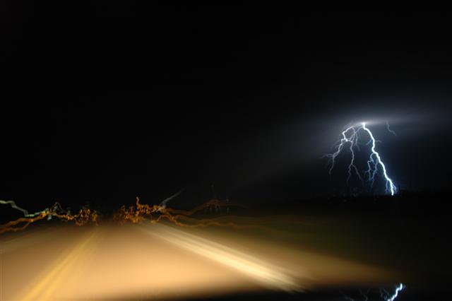
Working north from Concordia we made our way through York, Grand Island and Bassett, NE and eventually came across tornado damage in Keya Paha county that occurred earlier in the year. By late afternoon... storms began to form near Valentine, NE and Mission, SD. These storms moved east toward Winner, SD and were outflow dominated....but they still provided us with a few reasons to get the camera gear out: ONE TWO THREE FOUR FIVE. With lightning popping like crazy... we decided to head south into Nebraska again and see what we could come up with. At first... it was one amazing sunset! The broad range of colors was some of the best I have ever seen. Nothing has been done to enhance this image. Just a Nikon camera set on auto - aim and fire! Afterward...there was some impressive lightning to be had: ONE TWO THREE
Tour 2 June 9 - 7:02 p.m. - 11:56 p.m. CDT (4 hrs 54 min) 8970-9260 (290 miles) (GP LE) MAP
Travel day to Concordia, Ks.
Tour 2 June 8 - Down day spent in Oklahoma City
Tour 2 June 7 - 8:58 a.m. - 2:28 a.m. CDT (17 hrs 30 min) 8124-8926 (802 miles) (GP LE) MAP
The Motel 6 near the airport in Sioux City does not have internet access. Without data, we left southward on I-29 toward Kansas City. The plan was to jump south into the warm sector and play convection that was expected to form along the front in eastern Kansas and western Missouri. Late morning storms in the KC area were becoming severe and we stayed near them for a time and monitored their progress for signs of organizing into mature supercells. By mid afternoon, it became apparent that the storms were not the main show and we moved further south into southeast Kansas. Here, we watched as small CU tried but steadily failed to evolve into storms.
Around 7 p.m., satellite pictures indicated that if there was any hope for development, it would be near the KS/OK border in Osage County. This was the only region that was sustaining TCU and had a few weak radar echos that was in our chase range.
We dropped south into Miami, OK and finally had first echos form 75 miles to our west near sunset. The first storm we targeted along the KS/OK border steadily evolved into a nice looking severe thunderstorm after sunset with a beautiful back-sheared anvil and increasing lightning. The lightning increased to continuous and provided us with several lightning photography ops.
We worked with this storm until lower clouds started limiting our photography. By this time, storms further to the southwest had become tornado warned in Washington and Nowata Counties in Oklahoma. We dropped south for more lightning photography but instead found ourselves looking into the notch of the forward flank meso-cyclone that had moved by Welch, OK and was heading into Miami. Our storm chase then became a “get out of the way” move southward letting the most intense storm and others pass by to our north. In the end, we did get to watch some very nice storms only wishing they would have started their showing a few hours earlier.
Tour 2 June 6 - 10:39 a.m. - 1:52 a.m. CDT (15 hrs 13 min) 7385-8124 (739 miles) (GP LE) MAP
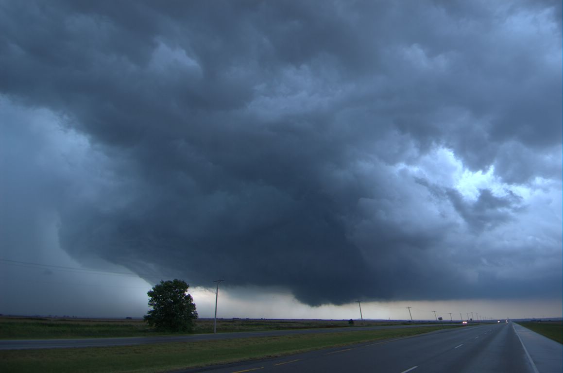
While a little confused about how the days events would unfold... it appeared that we would want to be in South Dakota. We met up with some British friends in North Platte and then started north. By the time we had got to I-90... a supercell had formed in the Bladlands. We were still 75 miles away from the storm when a tornado formed with it and despite it being visible from many miles away, it died before we could ever see it. Soon after, the storm evolved into a HP bomb and tracked northward across I-90. Cold pools associated with northwest Nebraska convection had plowed into our storm and resulted in a giant mass of windy outflow rapidly spreading through SD toward ND. We did have one storm that formed on the outflow that briefly became severe northwest of Mitchell, SD that we checked out near sunset and then headed toward Sioux City, IA for the night.
Tour 2 June 5 - 9:35 a.m. - 10:39 p.m. CDT (13 hrs 4 min) 6717-7385 (668 miles) (GP LE) MAP
We left Oklahoma City with the only goal to get as far northwest as we could. We had hoped that there would be some interesting storms in northeast Colorado by late afternoon. Those hopes were dashed when low level moisture ended up being quite a bit less than forecast. We watched moisture starved storms near Sterling, CO that pulsed along before fading away at sunset. We ended up the day in Big Springs, NE at a newly remodeled Motel 6 that had some great rooms at a good price.
Tour 1 May 29 - 7:59 a.m. - 7:42 p.m. CDT (11 hrs 43 min) 5831-6595 (764 miles)
Travel day back to Oklahoma City.
Tour 1 May 28 - 11:04 a.m. - 2:20 a.m. CDT (15 hrs 16 min) 4998-5831 (833 miles) (GT) MAP
We avoided a “cap bust” today... but just barely. Despite an environment favorable for supercell storms in the Dakotas... a strong capping inversion kept a lid on surface based convection. It was a long drive through South Dakota... and early evening when we arrived in Jamestown, ND. Storms were trying to get organized just north of the city and we finally had one near sunset that came close to severe levels before weakening. We did get the cameras out of their bags which prevented it from being a complete bust day... but it did end up being one of the least interesting of the tour as far as convection goes. We ended the trip just after 2 a.m. in Minneapolis, MN.
Tour 1 May 27 - 11:55 a.m. - 9:43 p.m. CDT (9 hrs 48 min) 4512-4998 (486 miles) (GT) MAP
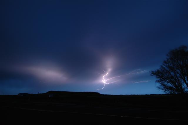
With a fairly unstable air mass in place over western Nebraska... the plan was to leave Limon, CO and move northeastward taking a look at storms and getting into position for what was supposed to be a better day 2 event in the Dakotas. We intercepted a severe storm north of Chappell, NE which produced a landspout tornado and likely produced some very large hail. Here is an image of the shrinking updraft as it weakened. We did make a few stops along the way and enjoyed the landscape of the Sand Hills before stopping in Valentine, NE. one two three
Tour 1 May 26 - 12:36 p.m. - 11:00 p.m. CDT (10 hrs 24 min) 4143-4512 (369 miles) (GT) MAP
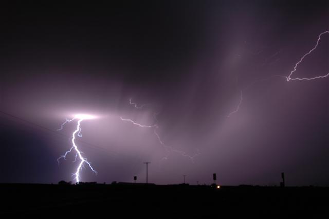
A weak upslope flow developed in eastern Colorado and there appeared to be sufficient instability for a few supercell storms in the fairly moisture starved environment. Once again, the plan was to have a few storms around at sunset to allow for some lightning photography. We drove west on I-70 all the way to the north side of the Denver metro area as convection bubbled overhead. One storm finally got organized in southern Weld County and started tracking slowly southeast. It had pretty structure for a period as it moved across the wide open landscape: one two three At sunset... the storm finally allowed us to shoot a bit of lightning: one two three
Tour 1 May 25 - 1:50 p.m. - 11:54 p.m. CDT (10 hrs 4 min) 3667-4143 (476 miles) (GT) MAP
Our hope for the day was that severe storms would form near the Kansas/Colorado border and move into western Kansas near sunset providing a chance of lightning photography. Conditions were not supportive of tornadoes. We drove west through the Oklahoma Panhandle and intercepted storms that had formed near Black Mesa State Park. While we did have some photo ops with the high-based activity... a steady rain in the most favorable area for after sunset lightning prevented us from getting many chances to shoot. We ended the day in Goodland, KS.
Tour 1 May 24 - Down day spent in Oklahoma City
Tour 1 May 23 - 11:19 a.m. - 12:41 a.m. CDT (13 hrs 22 min) 3194-3654 (460 miles) (GT) MAP
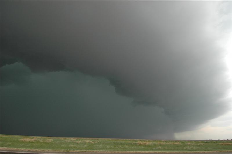
We left Dodge City and took a nice drive southwest through Beaver County and into Perryton, TX. We didn’t have time to waste looking at data once we got into the Texas Panhandle as supercells were already forming just south of us in Roberts County. The first storm we jumped on gave us yet more very nice structure. A wall cloud organized with the storm and was producing some very rapid motions as it crossed near us along Highway 70 in the Canadian River valley. It appeared that the storm came very close to producing a tornado at this time...but just couldn’t get it done. We spent the remainder of the afternoon dodging hail cores as the storms evolved into nasty looking HP supercells.
Tour 1 May 22 - 11:53 a.m. - 12:23 a.m. CDT (12 hrs 30 min) 2764-3193 (429 miles) (GT) MAP
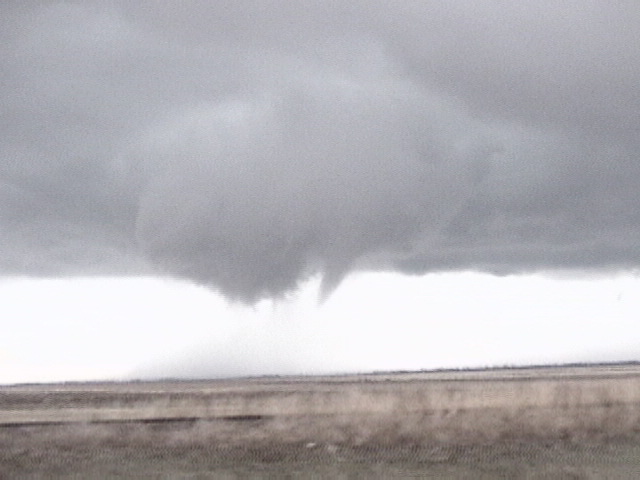
TORNADO: 7:11 p.m. - 7:17 p.m. / 8 miles south southwest of Hill City, KS
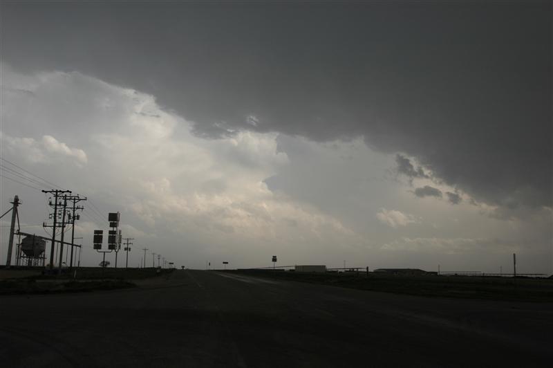
The kind of day that can make a chase season! We left Woodward and drove to Dodge City, KS where we would spend over an hour checking data and waiting. The dryline was making slow progress eastward toward Dodge City and a moist/unstable fetch of air was spreading north and wrapping westward along I-70. We decided to head north toward Ness City, KS and take a look at some more data. Before we made it to our data stop, storms began forming in Lane and Gove Counties. They quickly became severe and started moving northeastward. The lead storm didn’t take long in getting a supercell appearance. It moved slowly northeast being trailed closely by a small LP supercell.
Rotation increased with our target storm and a Tornado Warning was issued. For a time... rotation in the wall cloud was strong enough to make me think that a tornado would soon form. (pic pic) Just about the time things were really getting interesting... the rotation seemed to weaken and the storm started looking a bit less organized. Looking to the southwest... it became evident as to the possible reason why. Another large supercell had just formed and was rapidly organizing.
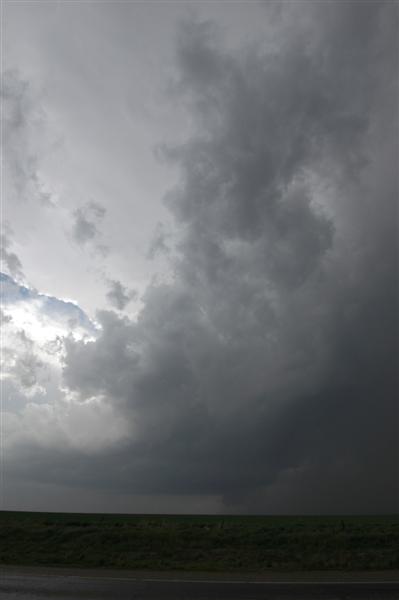
This storm was a lot larger in size and had amazing structure! This storm provided many photo ops as rotation steadily increased. (pic pic) Shortly after 7 p.m... a small tornado was produced about 8 miles south southwest of Hill City. (vidcaps: one two three four five six)
While the tornado was a plus... the storm structure stole the day. Another supercell would form in this group before it was over and we got a nice look at the backside of the storms as sunset approached.
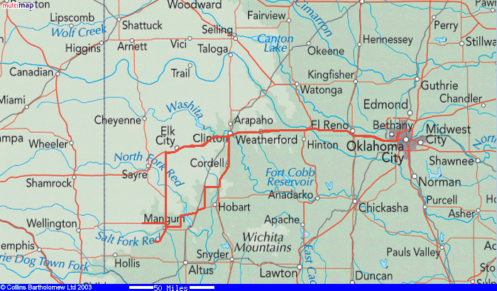
Tour 1 May 21 - 10:40 a.m. - 9:53 p.m. CDT (11 hr 13 min) 2415-2764 (349 miles) (GT) MAP
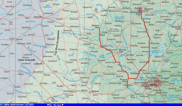
High based storms formed in the dry air over northeast New Mexico and the northwest Texas Panhandle. A few other attempts at initiation took place southwest of Amarillo and a complex of storms formed in northwest Texas that moved into southwest Oklahoma. In the end... it was a messy day. By late afternoon... we decided to commit to the activity that was moving eastward through the northern Texas Panhandle. The storms were a bit mushy and outflow unbalanced. We ended up staying just east of a rather ugly looking severe storm as it passed by Perryton, TX. Our day ended in Woodward, OK meeting British chasers James Banham, Peter Scott, Tom Lynch and Steve Lansdell.
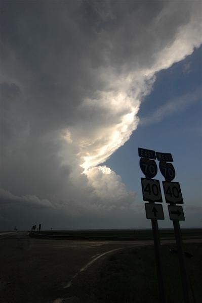
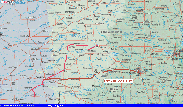
Tour 1 May 20 - 3:04 p.m. - 8:13 p.m. CDT (5 hrs 9 min) 2147-2415 (268 miles) (GT)
Travel day to Amarillo, TX. The prospects for supercell storms looked pretty good from the Texas Panhandle into western Kansas on the 21st and 22nd.
May 6 - 1:13 p.m. - 9:28 p.m. CDT (8 hrs 15 min) 1468-1815 (347 miles) MAP
Hopes were a lot higher for the day than what eventually took place. The airmass was very unstable and there appeared to be enough remaining upper level flow for more supercells and tornadoes. The first storms during the early afternoon appeared to be developing nicely and there were rotating storms evident in northwest Oklahoma and Kansas. I took a southern target with storms moving into southwest Oklahoma from the Childress, TX area. It didn’t take long after getting into Mangum, OK to see that the storms just were not going to have it in this area, this day. Elevated and outflowish... I didn’t spend much time with them and made it home at a decent hour for a change.
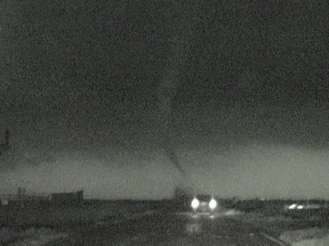
May 5 - 10:06 a.m. - 12:43 a.m. CDT (14 hrs 37 min) 769-1468 (699 miles) MAP
TORNADO NUMBER ONE: 7:56 p.m. - 8:10 p.m. / from south of Macksville, KS to north of Macksville, KS
TORNADO NUMBER TWO: 8:01 p.m. - 8:06 p.m. / near Dillwyn, KS
All the signs of an “Outbreak Day”. Very unstable conditions combined with excellent low and deep layer shear ended up producing many tornadoes. My day started in Concordia, KS and I left the hotel early for the southwest part of the state. There were early storms that formed that had my interest... but I became convinced that the main show was going to wait for late afternoon to get going. I stopped to watch a slightly elevated storm pass through the northwest corner of Barber County which had some worthwhile structure - grabbing a few pictures near Sun City (pic pic). Afterward... I continued my trip west to near Protection.
While passing through Protection... storms exploded to the southwest between Sitka, KS and Buffalo, OK. The first storm had slow rotation and nice structure as it passed overhead... but it was heading into Kiowa County where the previous days tornadoes had badly damaged areas around Greensburg. I’ve never had to let a storm go before because it was heading into a damage area that would have given me travel problems. The next storm moving up from the southwest also had nice structure and a wall cloud to the southwest of Protection. By this time... I had scouted out road options that would take me well south and east of the Greensburg area and decided to keep this as a target storm.
My trip through southeast Kiowa County took almost 45 minutes. The entire time I watched radar and saw that shear in my target storm was really increasing as it moved northeast of Greensburg. I was convinced it was producing a tornado when I headed north out of Cullison. Shortly after passing Byers, KS... a low contrast, but very large tornado, appeared to the northwest. I would watch this tornado for the next 14 minutes as it passed close to Macksville. Another tornado formed just north of me near the town of Dillwyn. This tornado was a lot smaller but had a very dynamic debris cloud for a few minutes. Being well after dark and having a messy radar... these were the only events I was willing to hang around for. The storm produced other tornadoes as it moved north of St. John. I briefly saw what may have been a cone tornado about 5 miles northwest of St. John but didn’t have the video running at the time. VIDEO: time lapse of large tornado - one / two smaller tornado
May 4 - 11:14 a.m. - 12:30 a.m. CDT (13 hrs 16 min) 186-769 (583 miles) MAP
I arrived in Dodge City, KS at mid-afternoon to find that southwest Kansas had mixed out and dewpoints had fallen into the 40's. The cap was very strong and appeared would be capable of holding firm during the daylight hours in the moist axis that had shifted to the east. The only place with cumulus remaining on satellite was along the I-70 corridor where moisture was wrapping around the north side of the dry slot. After talking with Mike Umscheid at the NWS in Dodge City... I made the decision to head north. I would keep an eye out to the southeast in case something could form before sunset... but also hope that something could be generated in the CU field near I-70.
I rolled into Wakeeney, KS just after 5:00 p.m. and found that the CU that had been quite flat was starting to bulk up a bit...especially to the northeast of the town. After sitting in the Wakeeney area for an hour... the decision was made to continue moving northeast following the best CU development. This was kind of a “what else is there to do” move.
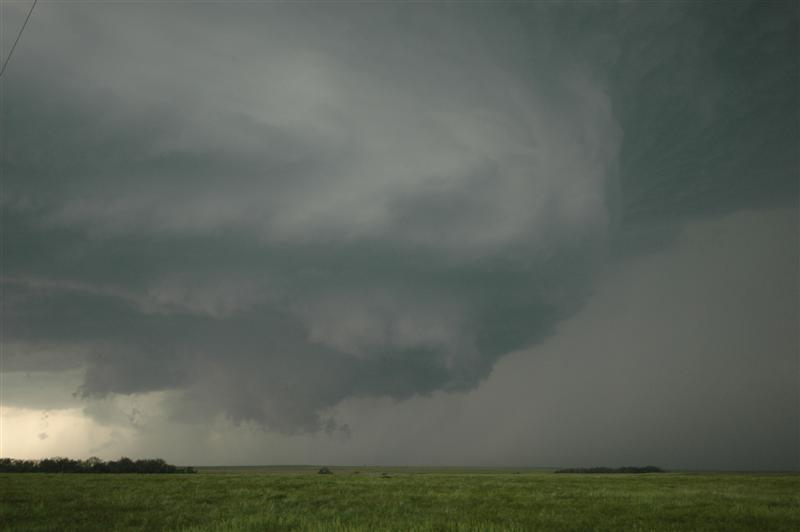
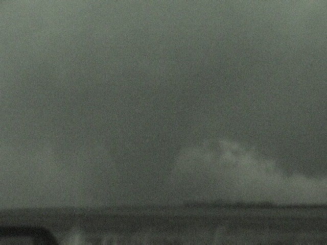
Shortly after 7:00 p.m.... the TCU rapidly evolved into nice looking CB’s (pic pic) just east of Stockton, KS. One storm took hold near the town of Woodson and was moving toward the southwest side of Smith County. This storm quickly developed a nice updraft region and steady rotation. A Tornado Warning was issued and there was a brief period of time that it appeared capable of producing a tornado. As quick as it did... it went away. The storm started looking ragged and elevated and I left it near Smith Center. After taking a look at some other nearby storms... I grabbed a hotel in Concordia and watched radar with amazement as the powerful supercell that hit Greensburg, KS continued impressive passing Great Bend.
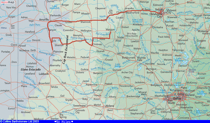
April 24 - 9:45 a.m. - 11:47 p.m. CDT (14 hrs 2 min) 163625-164349 (724 miles) MAP
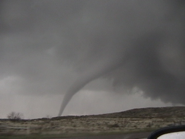
TORNADO: 7:21 p.m. - 7:30 p.m. / 3 miles west southwest of Nickerson, Kansas
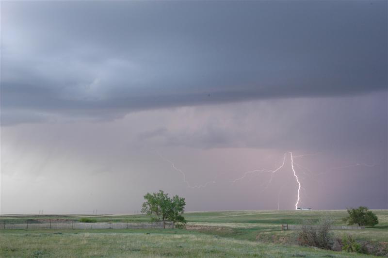
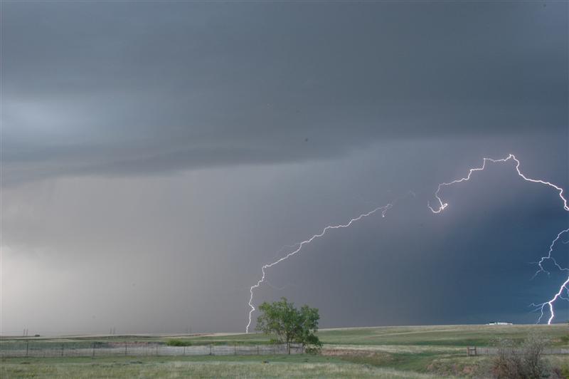
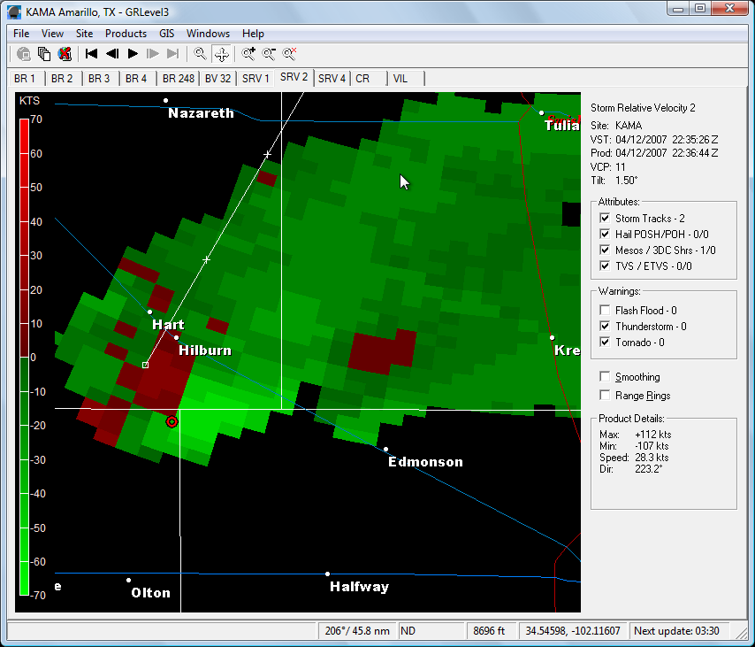
In the 'never let your guard down' department...I ended up on the Reno County Kansas tornado. But I sure took the long way to get there. At 9 a.m. this morning....I decided if I was going to give the day away to chasing....I might as well go ahead and get to the best spot....so, I headed north quickly on I-35. The decision was made easy as the large mess began to organize in southwest Oklahoma. The Oklahoma storms gradually extended into south central Kansas by late morning and one of the storms southwest of Wichita took on a supercell look on radar. Visually...I never saw it in the low clouds and haze. But....thinking anything was possible today...I jetted northeast of Wichita with a plan to intercept. It never made it out of the ground clutter alive. My next decision was to go ahead and get up to Salina....not really knowing how the day was going to unfold...I figured that I-70 was the best thing to do and just be ready to move east/west to intercept anything that came up. At this time...I was figuring on storm movements to be near 50 mph. I based that on the early junk....but come to find out that seemed mostly elevated and rooted supercells later in the afternoon along the dryline were moving a lot slower. Around 2 p.m....I misjudged the dryline location.....still don't know exactly what I was looking at or where I came up with it....but I believed it to be moving to near I-135. The convection that was moving through that area (that I believed to be on the dryline or very close) looked like crap and I decided that early storms must have cluttered things up enough that we were never going to recover. I started back toward Oklahoma and soon got a call from another chaser. He told me that the play was still forthcoming...I just needed to go west. Hesitant to believe him as the day was turning into a long one...I stopped and downloaded a satellite loop which indeed showed the dryline nicely - several counties west! I went west out of McPherson and ended up under some nice convection near Ellsworth. I dropped south as reflectivities came up and stopped a few times to shoot images of the various updrafts. They were nice looking at times....but small enough that I didn't consider them a threat to produce tornadoes. I eventually made it all the way down to tail end charlie in Reno County. Talking to Doug Speheger... I said "I don't have a degree or anything....but I don't think it's a good thing if you can see through the updraft". I told him that the convection was still nice enough that I was going to go south and get some structure shots and time lapse. Now....99 times out of a 100....I usually stick with the updraft just in case it produces - and usually it doesn't. I'm sitting fat, dumb and happy shooting some great supercell structure and getting about 25 minutes of video for time lapse....when all of a sudden Reno County turns red on the threat net. Rats! I had moved to a position far enough south that I never fully saw the storm make it's transition from incredibly average to amazing supercell! The storm structure coming in from the south was not to be believed by someone that had driven under the pathetic excuse of a storm 45 minutes earlier. Arriving on scene I was greeted with yet another strongly rotating wall cloud. A funnel extended 2/3s the way to the ground and numerous dust whirls were noted for the next 10 minutes. It appeared that this was one event that was a very broad - mostly weak - multi-vortex. On a side note...I was coming into Wichita on the way back and saw an unreal meteor. It was glowing above the high clouds for a couple of seconds before it burst through and then broke up. Very cool! - Time lapse of updraft - Time lapse of wall cloud/brief tornado
April 23 - 11:22 a.m. - 1:16 a.m. CDT (13 hrs 54 min) 163086-163625 (539 miles) (DS) MAP
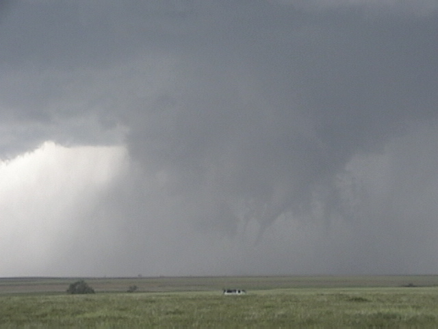
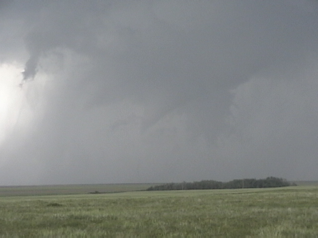
TORNADO NUMBER ONE: 6:51 p.m. / about 4 miles northeast of Laverne, Oklahoma
TORNADO NUMBER TWO: 8:24 p.m. - 8:30 p.m. / southwest-west- west.northwest of Protection, Kansas
TORNADO NUMBER THREE: 8:30 p.m. - 8:36 p.m. / southwest of Protection, Kansas
TORNADO NUMBER FOUR: 8:28 p.m. - 8:38 p.m. / on the ground a few times west and northwest of Protection, Kansas
Since I have been running behind getting things caught up both at work and home... I decided to let chase partner Doug Speheger describe our day. He put together a great summary complete with information from our GPS data and radar images. This information can be found on his website at http://www.spegweb.com/chase/2007/index.php#070423.
We initially were targeting the eastern Oklahoma panhandle and drove out to Elmwood, OK. We were pretty close to the initial nearby development that began to develop just to our east. So we back-tracked to the area south of Laverne, but the initial storms that were trying to develop dissipated. But storms continued to try to form in the area, and we set up camp south of Laverne, OK for an hour and a half and just waited for a storm to take hold. Finally, one storm in the northeastern Texas panhandle developed more, became severe and moved into northwest Oklahoma just to our south, and was basically moving right to us. A tornado warning was even issued, and we drove south a few miles so we could view the thunderstorm base quicker. When we first saw the storm base we saw a lot of scud that looked ominous, but we saw nothing tornadic. But there was some decent organization at times as media helicopters flew around, but still no tornadoes during our view of the storm.
The storm seemed to always be in transition with fast development and then disorganization. As the storm moved northeast through Harper County, we did see a brief tornado to our west. Unfortunately, we were driving and a ridge to the west cut off our view soon after we saw it develop (and thus, no picture.) When we got another view a couple of minutes later, it was already gone.
There always seemed to be a lot happening and often more than one area of interest under the storm as it continued too move northeast. As the storm approached the state line, it became much more organized and developed very strong rotation and upward motion, with some scud tags developing just a few hundred feet above the ground, rising quickly, and rotating around a radius of a few hundred yards. It was some of the most impressive motion that I have seen, but never developed a condensation funnel or any typical visual cues of a tornado despite the strong very low-level rotation.
After a few minutes, this rotation disorganized. With poor road options to stay with the storm, we left the storm for a while to drive north into Kansas, then east to near Protection, KS and get ahead of the storm. As the storm approached, a tornado developed southwest of town and moved north or north-northeast. While this tornado was in the occluded part of the storm, another tornado developed to its east, closer to (but still west) of town. Although the second tornado looked like it was going to develop into an organized and large tornado, the visual contact with the ground was brief and it looked like it was constantly in a “incipient” tornado stage. We could confirm it in contact with the ground a couple of times. Meanwhile, the tornado in the initial area of the storm continued, even with the second area of interest continuing to try to organize to its east. We have heard rumors that there may have been multiple tornadoes in the western area, but we could not tell for sure from our distance, although our initial guess was that we were watching a single, 15-minute (approximately) tornado. The second area also continued to develop visible funnels and perhaps brief contact with the ground as we lost sight of the western tornado in the rain and darkness. We followed the storm north of Protection, but did not have the best visibility with the growing darkness after sunset.
* The following links are to some of my pictures and video captures of the Protection storm: 1 2 3 4 5 6 7 8. Here is also a short video segment of portions of the event.
April 21 - 11:18 a.m. - 1:08 a.m. CDT (13 hrs 50 min) 162404-163085 (681 miles) (DS) MAP
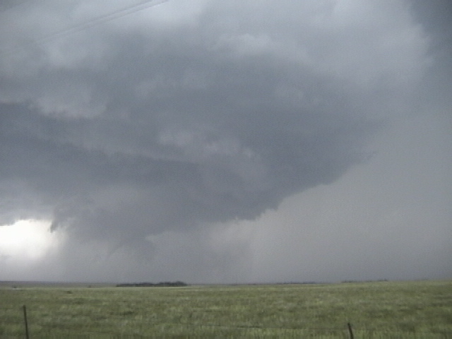
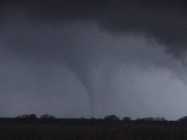
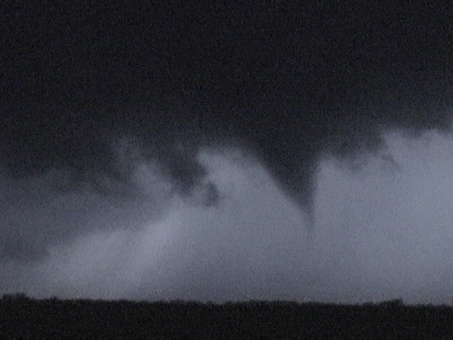
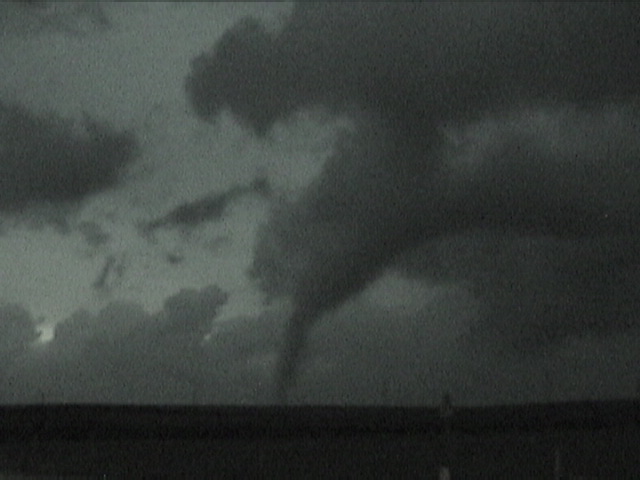
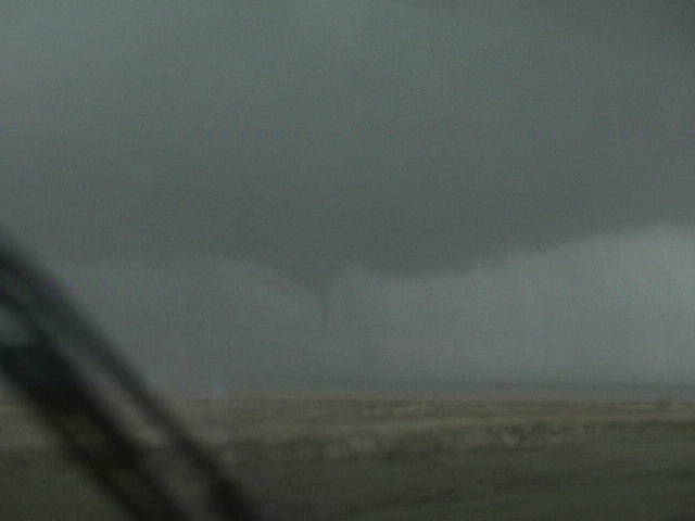
TORNADO NUMBER ONE: 6:52 p.m. - 7:27 p.m. / 5 miles northwest of Boys Ranch, Texas to 11 miles west of Dumas, Texas (22 miles)
TORNADO NUMBER TWO: 7:15 p.m. - 7:38 p.m. / 8 miles southwest of Dumas, Texas to Cactus, Texas (16.5 miles)
Time and location of tornadoes estimated
Chase partner, Doug Speheger and I had a lot of questions as we left Oklahoma City. There were concerns about moisture and mode of convection that had us wondering if the whole day may be a wash. But, it was late April and there was a strong storm system approaching... so we headed to the Texas Panhandle to see if a little “magic” could be accomplished.
We set up camp in Amarillo and watched as cumulus bubbled to our west. Soon... storms began to organize along the Texas/New Mexico border and a few other storms began to form in the row of counties to our west. We drifted southwest of Amarillo and stopped southwest of Wildorado. There were three supercell storms close to us (northwest - west - south) that showed steady intensification... becoming severe and producing hail. On radar... the storm to our south near Hereford looked the best. But... as time went by... structure with the storm just west of us had become quite impressive.
Our target storm made a couple of attempts at producing tornadoes without success as it passed Vega moving to the north northeast about 45 mph. We were concerned enough about its potential that we briefly considered moving to another storm... but we were receiving steady radar data that suggested the storm was still rotating strongly in the mid-levels and that low level rotation was increasing. With this in mind... we stuck it out for the next attempt at a tornado and we were not disappointed. The cloud base rapidly lowered... rotation increased and we soon had a tornado (ONE TWO) just northwest of Boys Ranch. The tornado tracked quickly northeast and crossed the road within 1/2 mile of us and starting becoming larger to our northeast. Driving in heavy rain... we lost sight of the tornado while we drove through Channing. About 8 miles northeast of Channing... we had a close call with the very large tornado. We decided to keep safe and let the tornado pass just to our east. Image of east edge of tornado that is near 1/2 mile wide (looking south while backing up). While tornado number one was on the ground... the second tornado of the day formed to our northeast - about 8 miles to the southwest of Dumas. This tornado always stayed a step ahead of us and we were never able to get into a position of good contrast. However... it was evident on several occasions that this became a very large tornado - likely on the order of 1/2 mile wide or more - as it approached Cactus. After becoming wrapped in rain a final time... we moved away from the storm and started toward home. We passed close enough to observe a tornado warned storm near Dumas... but didn’t see any more tornadoes.
April 13 - 10:00 a.m. - 8:50 p.m. CDT (10 hrs 50 min) 161791-162248 (457 miles) MAP
I left Mangum, Oklahoma a little too early and ended up driving right by Baylor County, Texas where the storm of the day would eventually evolve. I spent several hours in the Jacksboro, Mineral Wells and Springtown, Texas areas before it became obvious this was going to be one giant car wash. Deciding not to follow supercells into the Fort Worth/Dallas areas... I caught I-35 at Gainesville and headed home.
April 12 - 10:50 a.m. - 10:45 p.m. CDT (11 hrs 55 min) 161257-161791 (534 miles) MAP
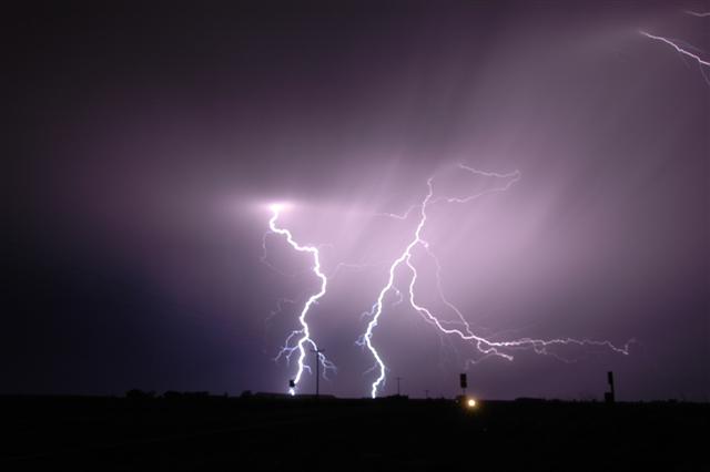
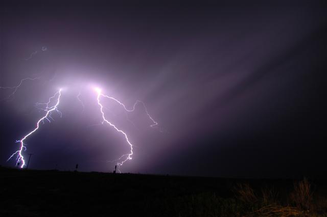
Limited moisture but impressive shear led to an environment conducive to high-based supercell storms in west Texas. I arrived in Tulia in the mid-afternoon to find the first signs of storm formation to the west of Plainview. As expected... the storms gradually evolved and one storm gained supercell structure as it approached Tulia. Radar from Amarillo showed some impressive mid-level rotation at times. Supercell structure: ONE TWO THREE FOUR FIVE SIX A fairly large grass fire was started by lightning just south of Tulia. The storms would go on to produce a large swath of hail up to 1.75 inches northeast of Tulia and in the Vigo Park area. Most of the stones were flat and mushy. After the storms became outflow unbalanced... I headed east and enjoyed the lightning show all the way to Mangum, Oklahoma. Lightning: ONE TWO THREE FOUR FIVE SIX SEVEN EIGHT
March 28 - 9:50 a.m. - 12:59 a.m. CDT (15 hrs 9 min) 160250-160850 (600 miles) MAP
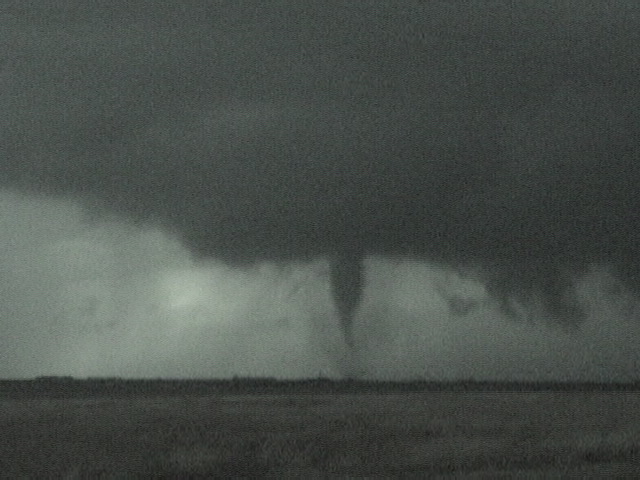
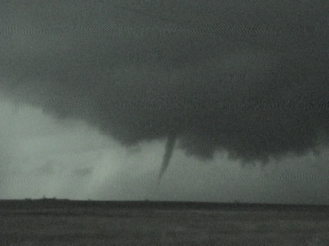
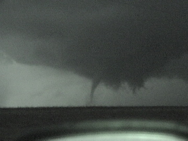
TORNADO NUMBER ONE: 7:42 p.m. - 8:05 p.m. / 3 miles west of Fowler, Kansas to 4 miles south southwest of Ensign, Kansas (14 miles) 1 2 3 4 5 6 7 8 9 10 11 12
TORNADO NUMBER TWO: 8:14 p.m. - 8:31 p.m. / 4 miles west northwest of Ensign, Kansas to 4 miles east northeast of Cimarron, Kansas (10.5 miles) 1 2
Time and location of tornadoes estimated
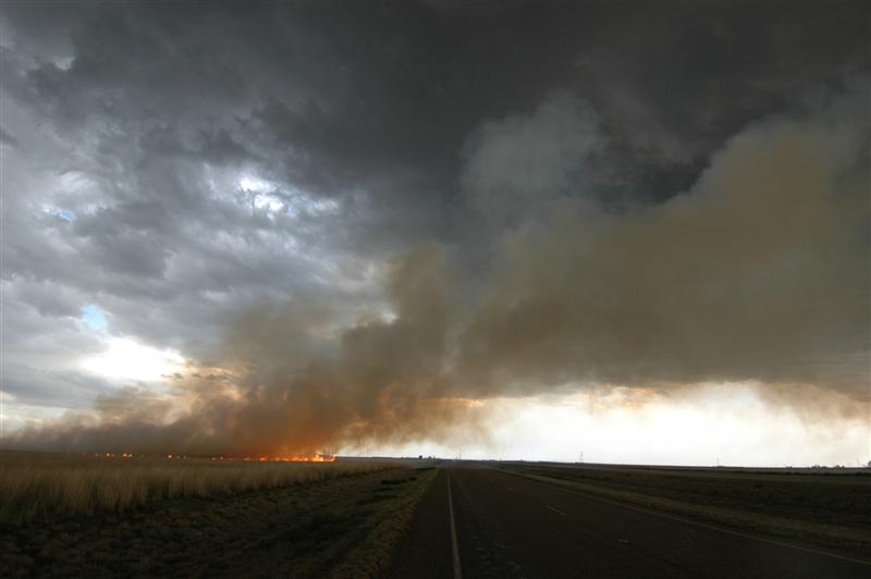
My initial target area was just south of Dodge City, Kansas which turned out to be pretty good. However, after getting into northwest Oklahoma at midday... I decided to head straight west through the panhandle... cheating a bit toward potential southern targets. Stopping in Elmwood, Oklahoma for gas... I held my position because it was one of the few places where there was a good cell signal during my trip through Beaver County. In a bizarre twist... I spent well over an hour talking to many locals about the severe weather potential. I met cowboys (real cowboys), oil field workers and truck drivers who all had an interest in what was going to happen later in the afternoon. Several changed their afternoon/evening plans after I told them that the large hail and tornado potential was pretty high. Despite knowing the potential... I was floored on my way home when I found out that the tiny community had indeed been hit by one of the evenings tornadoes causing two deaths. I can’t help but wonder if they were a couple of the people that I talked to hours earlier.
After leaving Elmwood... I drifted north to Beaver, Oklahoma where I spent the better part of two hours. The Texas tornado show was well underway... but I decided to hold to my target area, even if it meant being the only person who didn’t see a tornado this day. I spent time in the Beaver State Park and shot a little video of towering cu for time lapse. When the cu became more bulky... I started north on highway 23 toward the Kansas state line. Highway 23 is one of my favorite Kansas highways. There is usually NO traffic and wide open prairie that seems to go on forever. I took a few pics of the tcu and then continued on to a few miles south of Meade, Kansas. There the cu became cb’s and I shot a few more pics: ONE TWO THREE
In almost an instant... the small cb’s exploded into several severe thunderstorms with radar indications of very large hail. I followed the storms into Fowler, Kansas and worked my way in and around them until the southern storm decided to start rotating. It didn’t take long before the first debris was seen under the wall cloud west of Fowler... and this would start a 23 minute tornado that tracked straight north. The second tornado would last another 17 minutes. My video of the tornadoes was some of the worst I have ever shot. Being at night and trying to get the video while moving on muddy roads made it almost worthless. Outside of that, the day was pretty good. I was happy that my target worked out... and I did have a lot of fun at the end of the second tornado when I was standing outside the car about 3/4 mile from it.
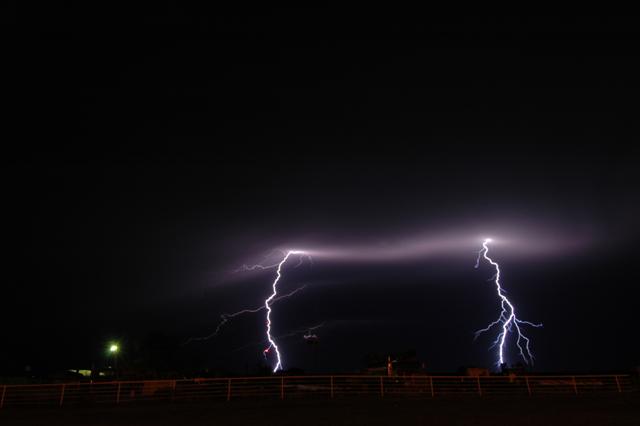
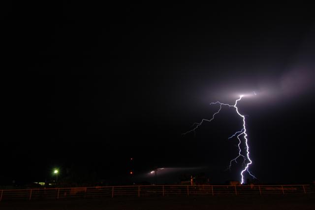
One of the most exciting events of the evening came on the way home when I was next to the wind generator farm between Fort Supply and Buffalo, Oklahoma. I was looking straight at one of the towers next to me when a CG blasted it! The bolt grabbed it for just a bit while sparks were flying off the top of the tower. Very cool!
March 24 - 9:30 a.m. - 9:27 p.m. CDT (11 hrs 57 min) 159606-160174 (568 miles) (VM) MAP
A small but strong upper system ejected quickly out of New Mexico into Colorado and Nebraska. The system had enough of our interest to make a trip to Dodge City, Kansas in case supercell storms were able to organize in western Kansas. They didn’t and we spent the afternoon making a big circle around Dodge City before returning. Just east of Dodge City... we took the time to shoot a bit of video for time lapse purposes.
March 21 - 11:44 a.m. - 2:46 a.m. CDT (15 hrs 2 min) 158695-159570 (875 miles) (DS) MAP
As quoted by my chase partner for the day, Doug Speheger - “This one is more for the camaraderie than the meteorology.” We knew this would be a long drive to near the Kansas/Nebraska border... but it ended up being quite a bit longer taking us all the way to I-80. The setup was pretty good for some severe storms... but marginal for tornadoes. Still... it was a chance to get out of the house and push everything through the paces. Plus I got to enjoy Doug at the top of his “bad pun” game. The best one of the day came as we drove into Reynolds, Nebraska with regard to not getting a speeding ticket: “You don’t want to get a Reynolds wrap sheet.” We played with a couple of supercells that had some nice structure for a time: ONE TWO We also got to play in a hail core near Crete, Nebraska where we measured 1.50 inch hail and saw a few stones laying around that may have been just a bit bigger.
February 24 - 7:48 a.m. - 5:40 p.m. CST (9 hrs 52 min) 157654-158179 (525 miles) MAP
This was a cold core (CC) chase day in central Kansas as a very strong storm system moved out of the Rockies into the Plains. It took a very early start to the day as I figured storms would be going near or before Noon. The first storms that I came across near Newton, KS had some nice structure but didn’t show a lot of motion in the updraft region for the period that I stayed with them. There were a few areas of generally weak rotation and an occasional funnel cloud... but something seemed to be missing to allow a transition to a tornadic phase. Here are a couple of views of the shallow convection: ONE TWO The final storm I came across was east of Salina near Carlton, KS. This storm actually had some decent structure to it with crisp convection, a wall cloud and a strongly rotating funnel cloud for several minutes. A fun chase day playing around in a situation where storms are almost guaranteed. A final shot of the Kansas prairie and bright blue sky before returning home.
February 23 - 1:14 p.m. - 9:35 p.m. CST (8 hrs 21 min) 157188-157653 (465 miles) MAP
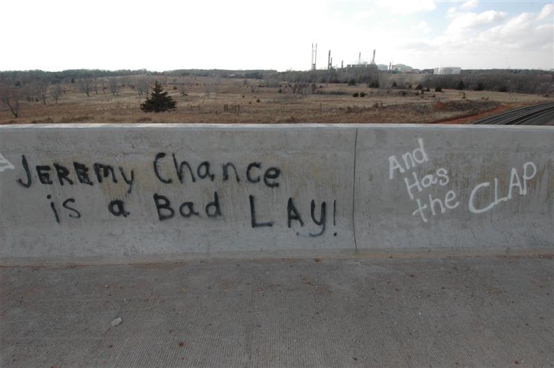
Questions about having daytime storms were answered when rapid severe thunderstorm development took place around 4:30 p.m. in the eastern Texas Panhandle. I was caught out of position as I expected development would also occur as far north as the Kansas border. My northwest trip was quickly changed southward after reaching Woodward, OK. Sliding south in advance of the organizing storms... I didn’t commit to one and waited for signs of a storm becoming dominate. I was only about 20 miles away from the McLean, TX tornado when it formed... but my attempts to get to the “needle in the haystack” were hampered by a bad road network and various technical problems in the car. How did we ever chase without GPS? The storm looked “stringy” and “mushy” by the time I reached it and it no longer looked capable of producing a tornado. With the early February darkness... I took the time to watch some lightning and headed back home. It was a good day to figure out some of my needs before the main part of the chase season arrives (wipers for one). The only time I took the camera out of the bag was to shoot some amusing graffiti just west of Woodward. I don’t know who Jeremy Chance is... but you ladies may want to avoid him!