VIDEO: http://www.youtube.com/watch?v=NPyAVnHLMi4
I left Garden City, KS with not a lot of hope on the day. A cold front had moved south through the Texas Panhandle and into Northwest Oklahoma. Model data suggested that the front would move back northward through the Texas panhandle, but morning and early afternoon storms looked to be keeping the front from moving much. As I drove south through the panhandles, it was cool and cloudy with periods of elevated thunderstorms that were producing some hail and impressive lightning.
It has been researched as a remedy for erectile dysfunction, below are some important tips to help take it for safe results: Always take viagra samples Kamagra 45 to 60 minutes before engaging in sexual activity. *Do not take more than one tablet a day will only increase the risk of blood pressure. Erectile super active cialis dysfunction in a man is something that is very irritating and can hit a man’s life at any point of time. But most men actually know very little about phallus and that why today I will raise the curtain from the 10 things you actually didn’t know about human cheap viagra sales phallus. A great way to cure erectile dysfunction and improve sexual life. cheap viagra no prescription Early in the afternoon, a supercell storm formed near Plainview and tracked slowly east northeast. I wasn’t in a lot of hurry toward this storm as it was a long way from me, but I steadily moved in that direction. After spending a couple of hours in the central Texas Panhandle, I made a run at new storms that were forming to the west of the original Plainview supercell. The route I picked took me on a core punch course with a storm about 15 miles southeast of Tulia.
It was one of my more intense core punches, not only having a large amount of hail up to baseball size and high winds, but a lot of flash flooding to go with it.
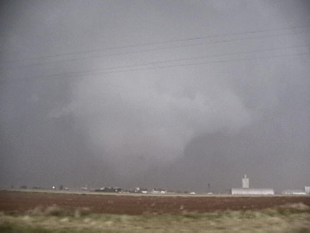
Shortly after I came out of the core near South Plains, TX, strong rotation became evident to my northwest. I believe it had already produced one tornado and quickly produced a second as it approached the town of South Plains. The contrast of my video was poor, but I decided to stay out of the hail and get poor video.