Category Archives: 2024

6 May 2024 – Weak Tornado, Major County, Oklahoma

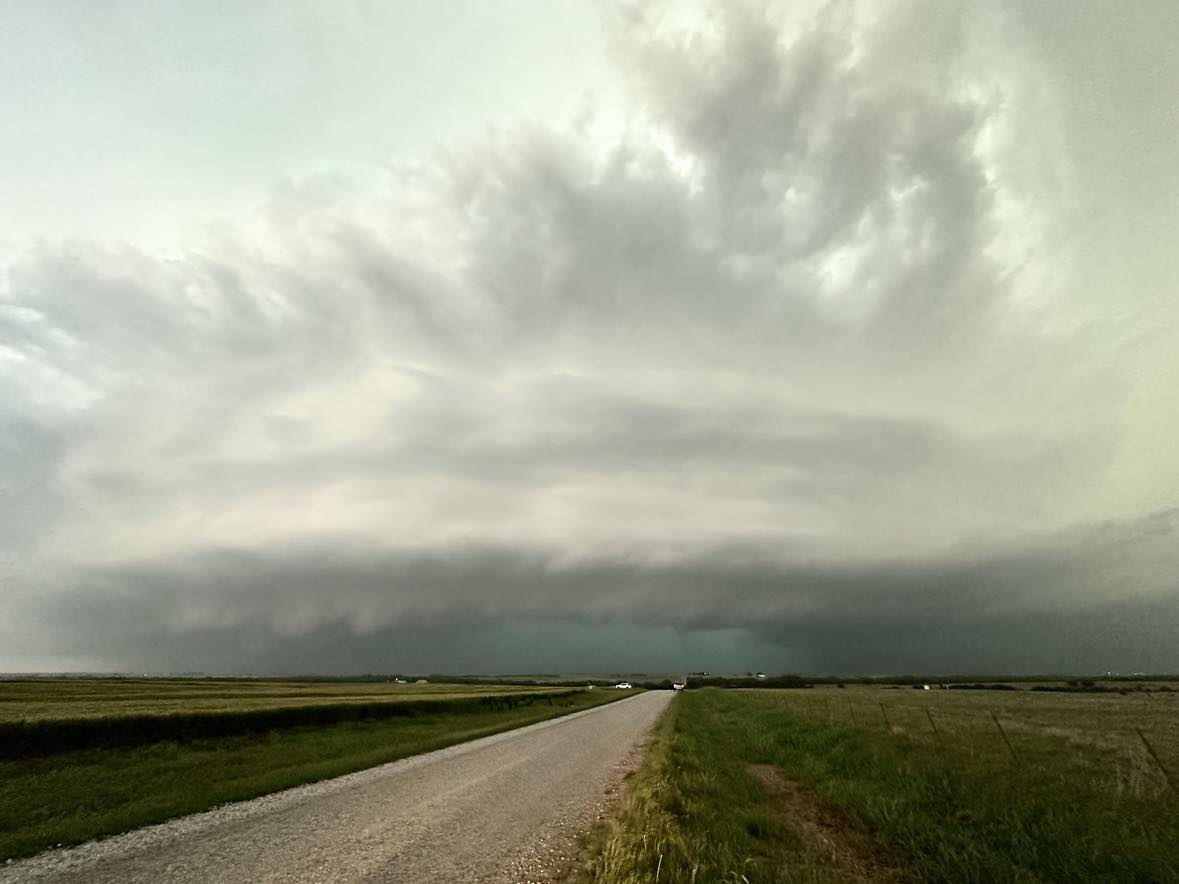
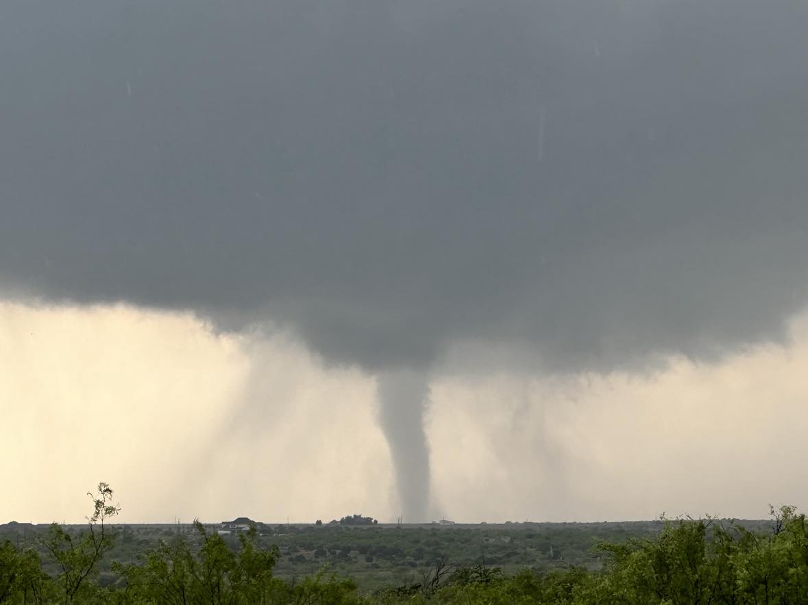
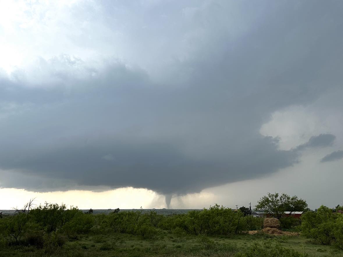
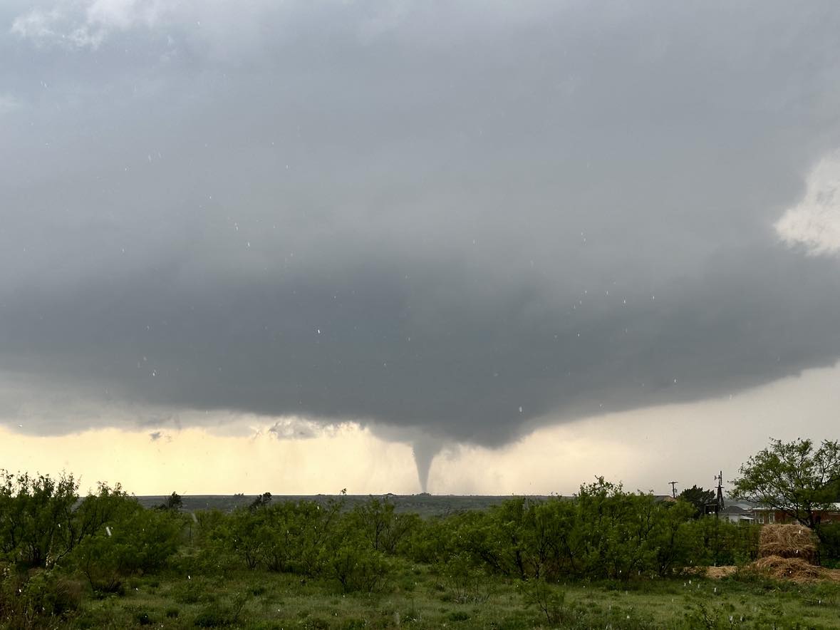
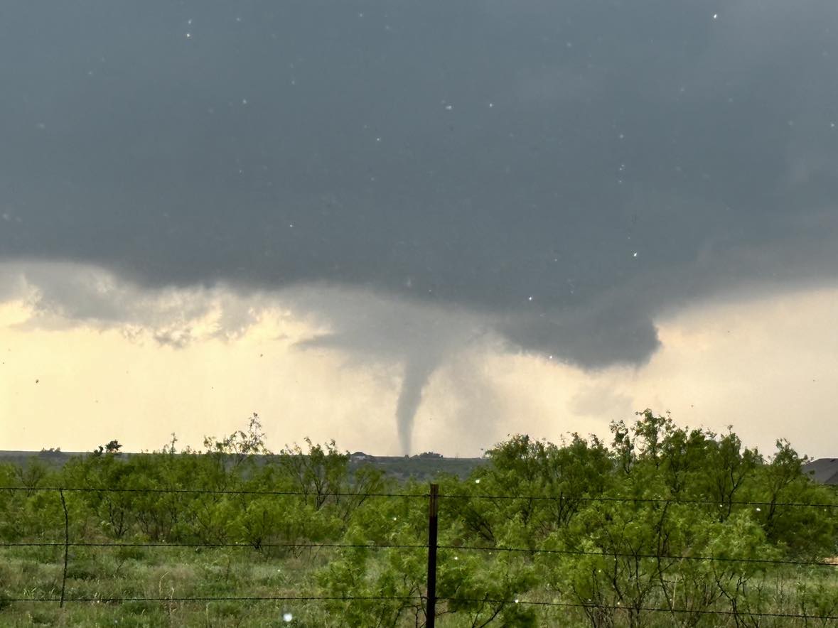
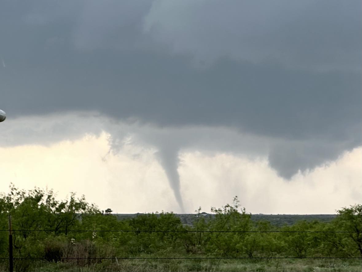
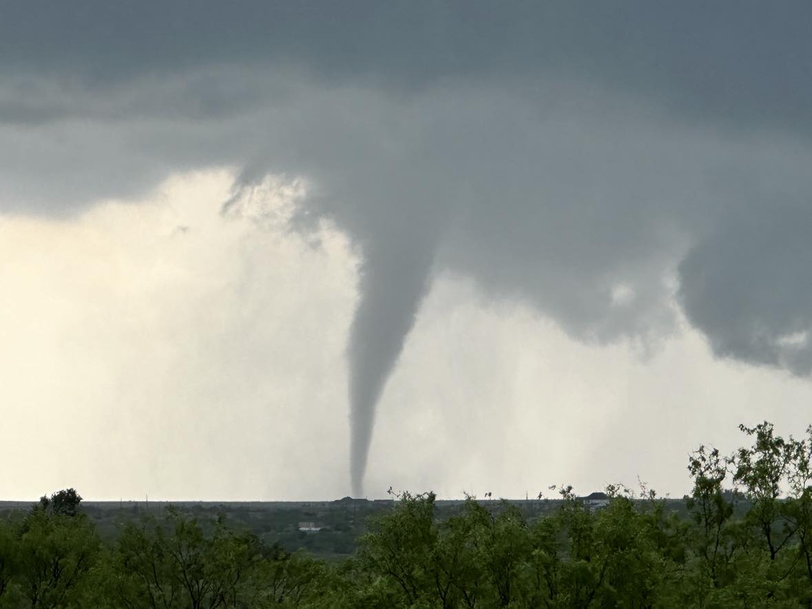
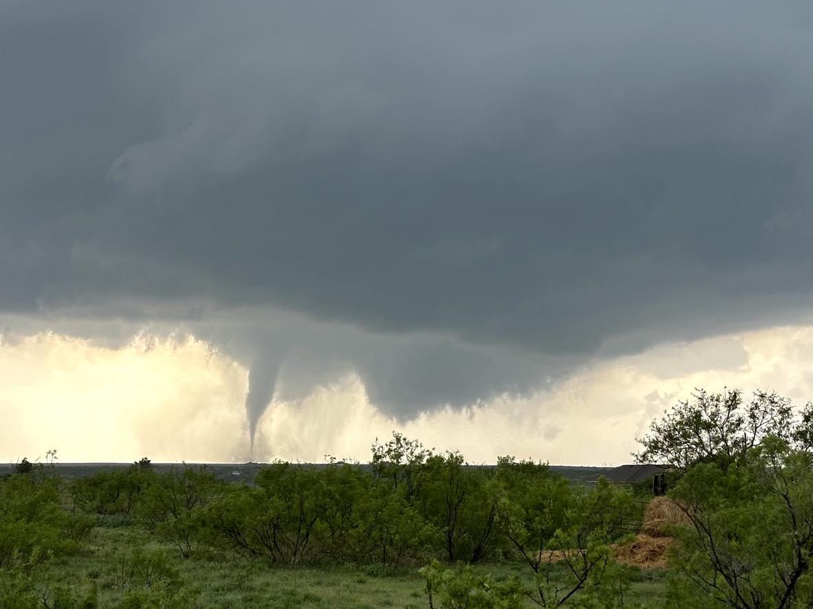
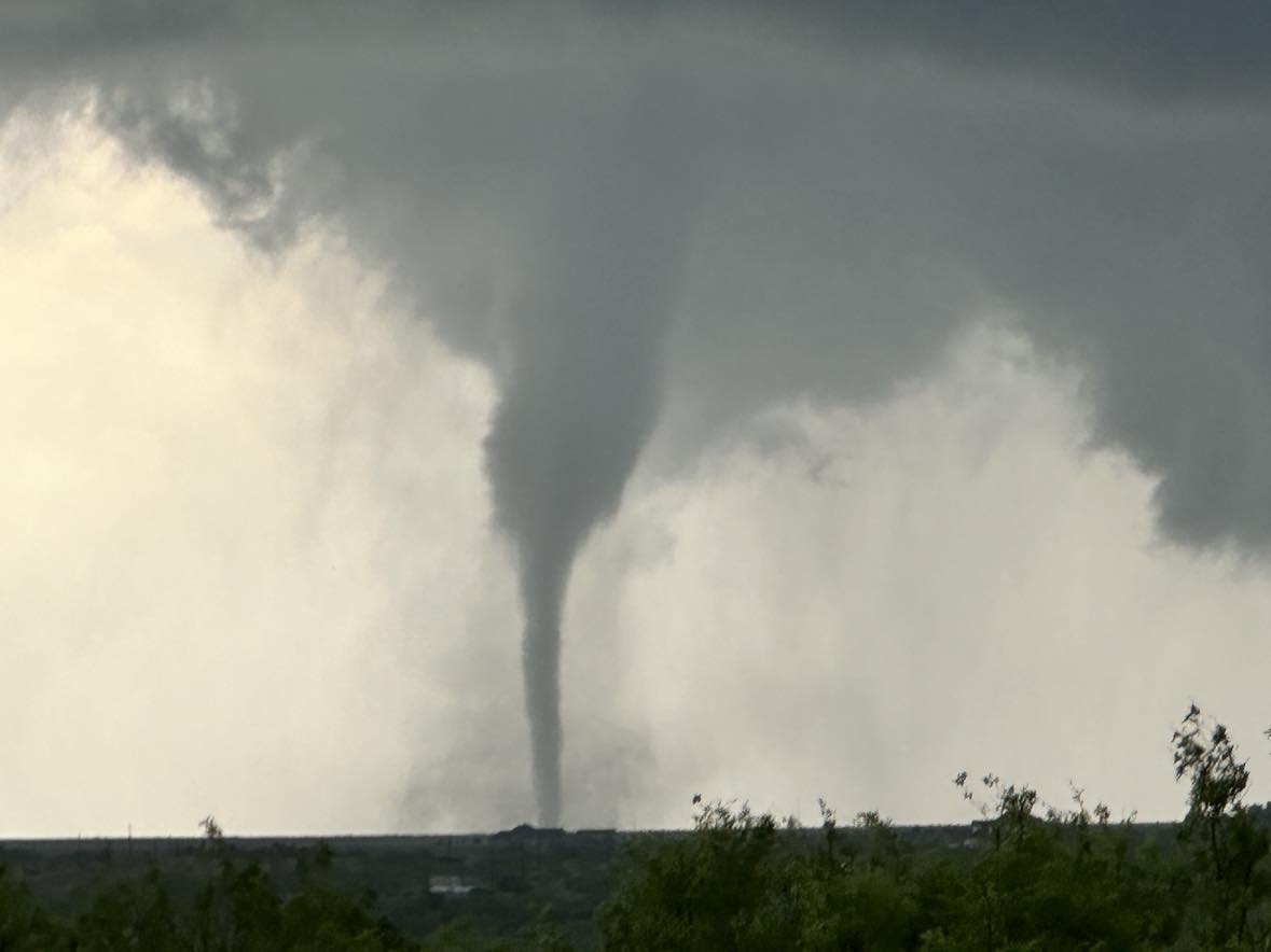
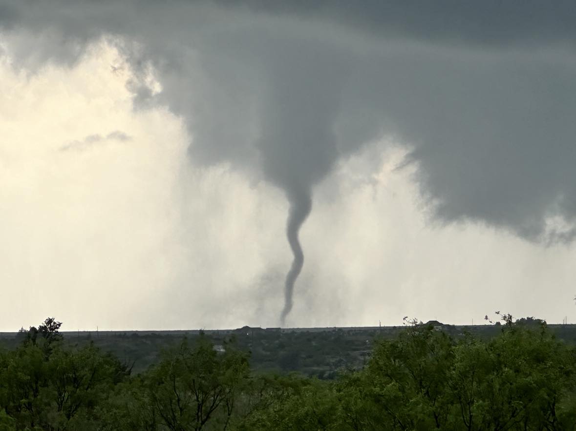
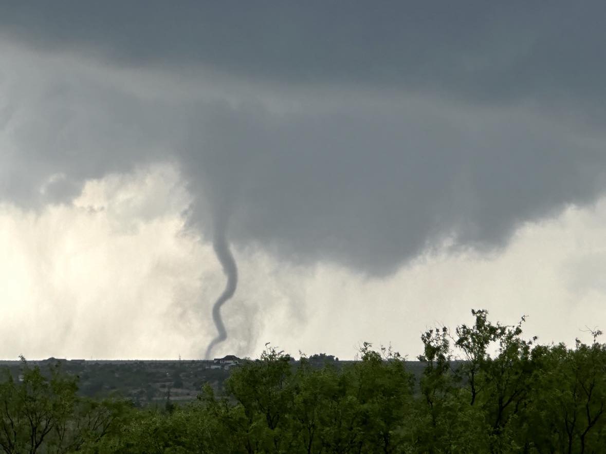
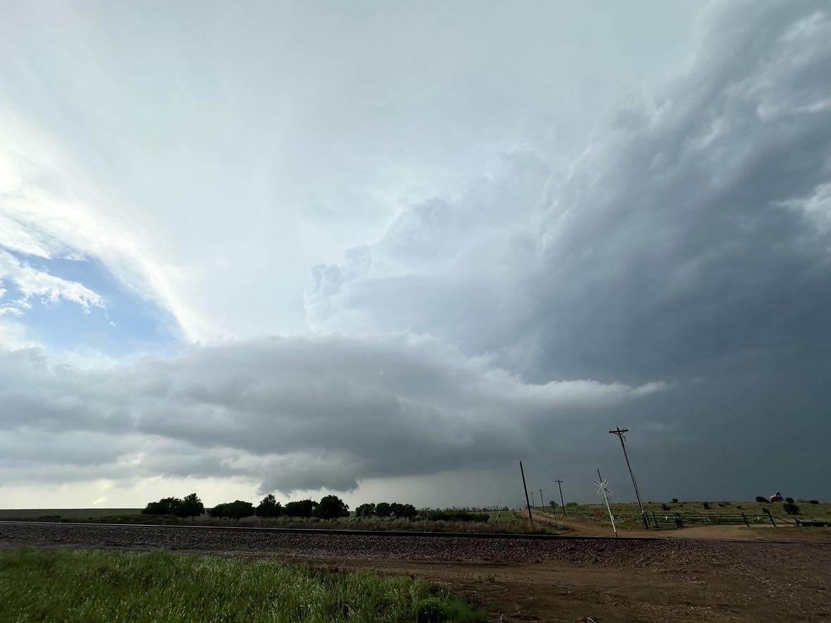
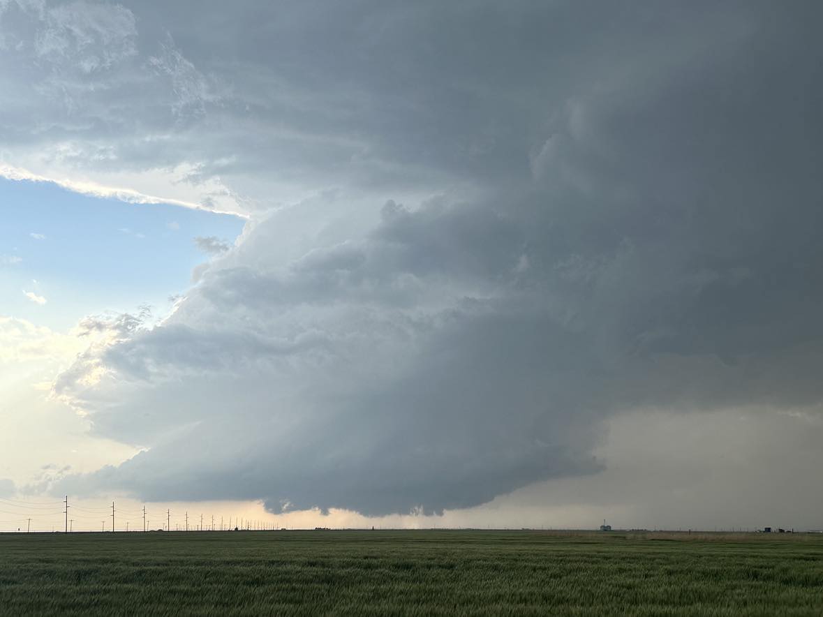
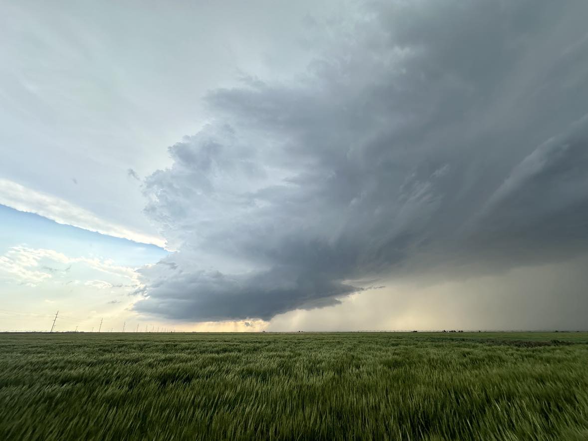
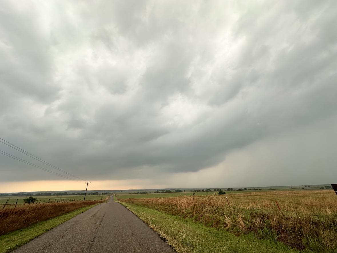
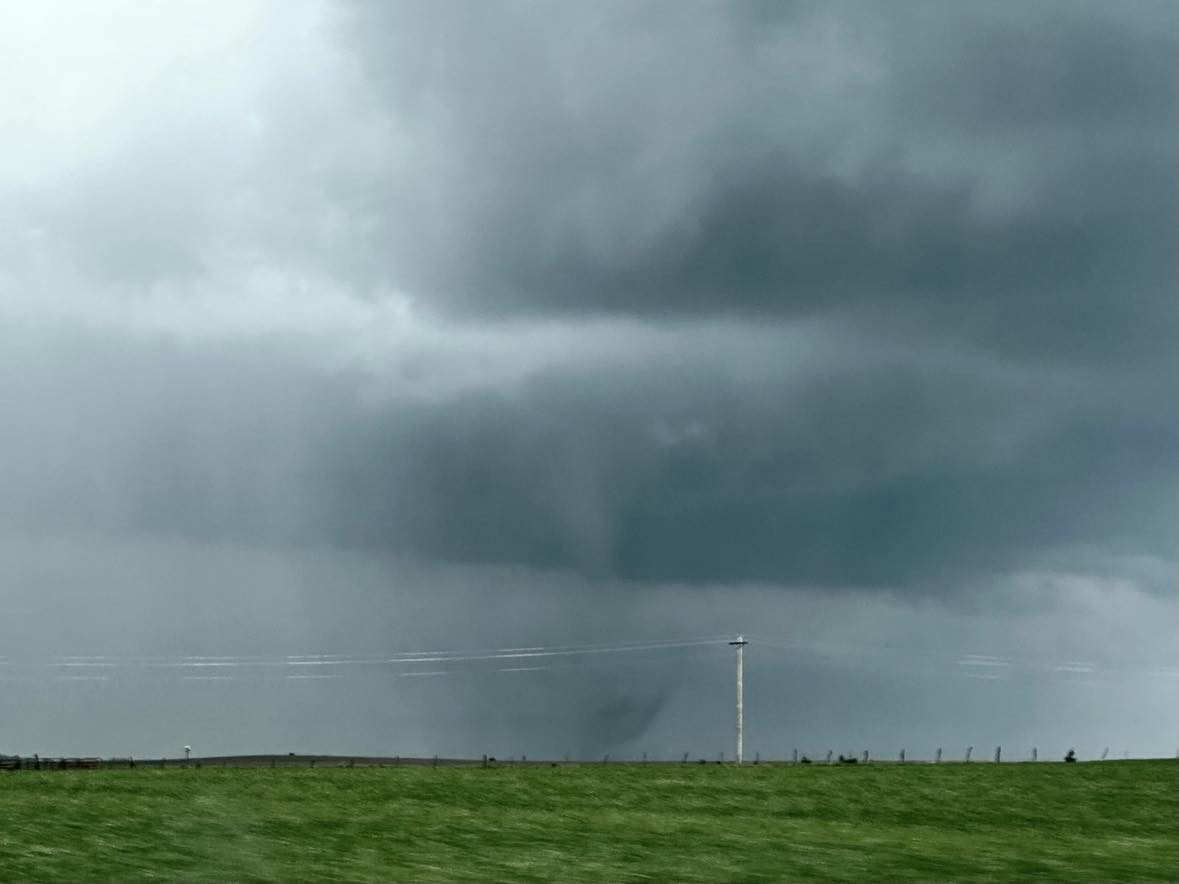
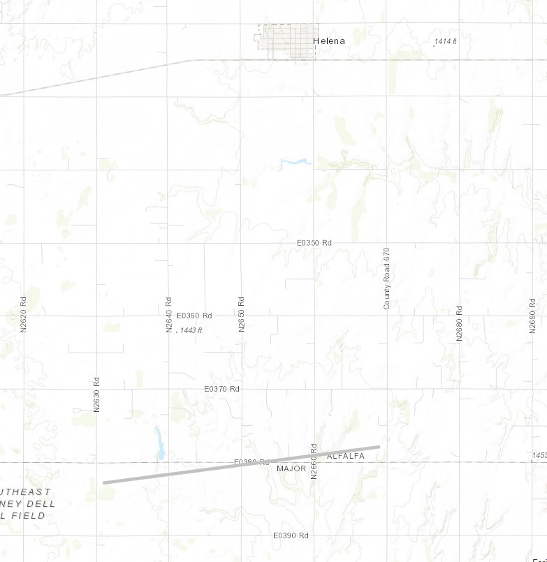
A fairly short chase on a high risk day in Oklahoma. We elected to jump on a storm northwest of Seiling that was moving northeast toward Major County. Considering how impressive parameters were on the day, the storm only gradually attained a nice appearance and began rotating.

Looking west from 2 miles southeast of Cleo Springs at 5:39 pm CDT
Looking west from 3.5 miles north of Ringwood at 6:01 pm CDT

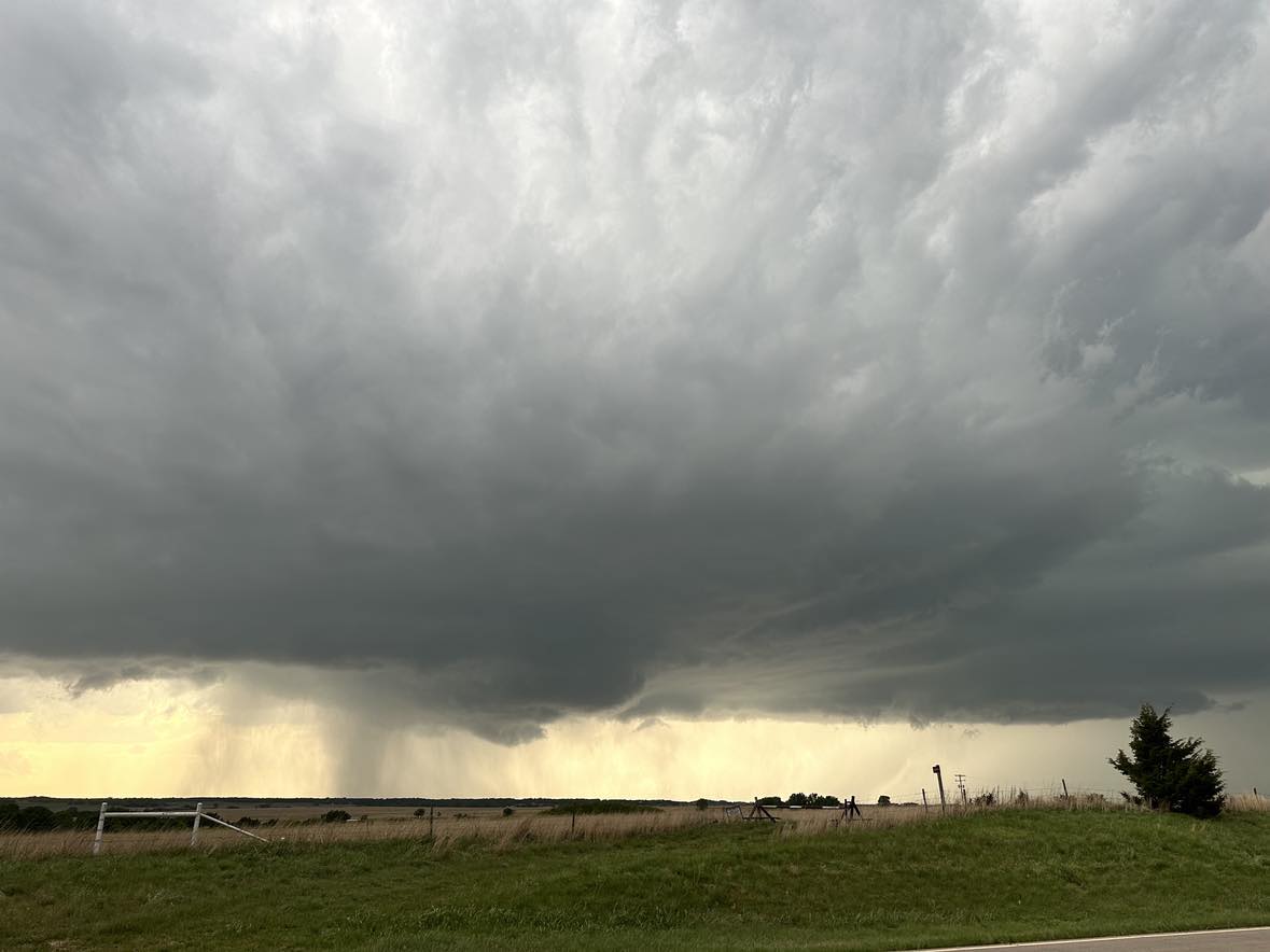
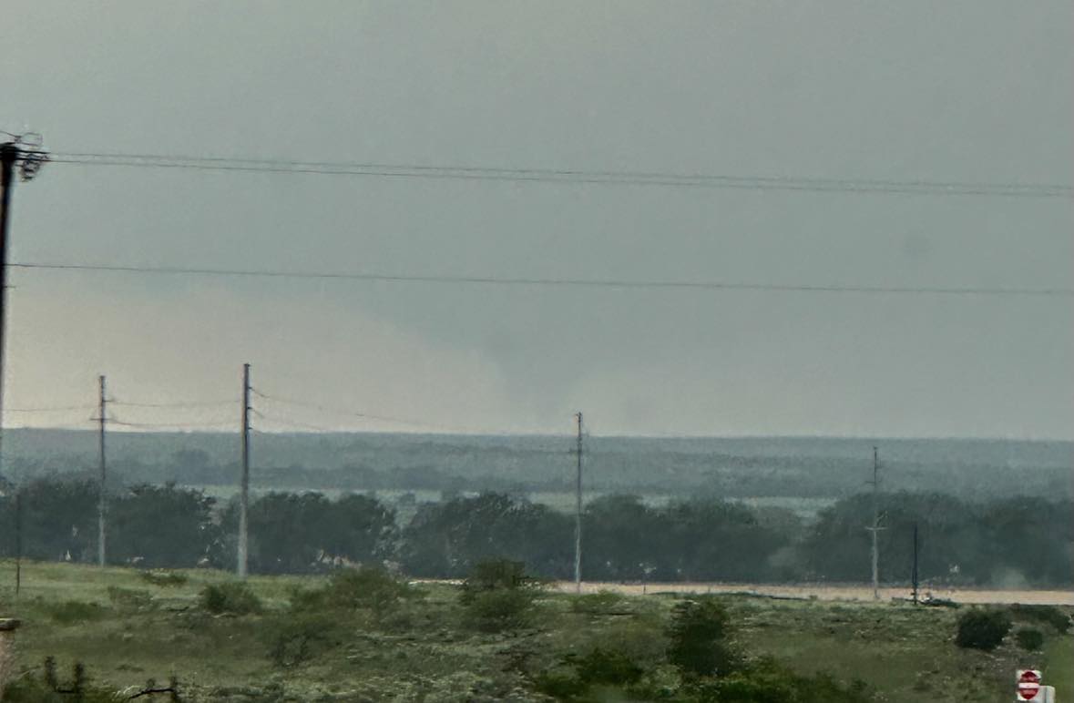
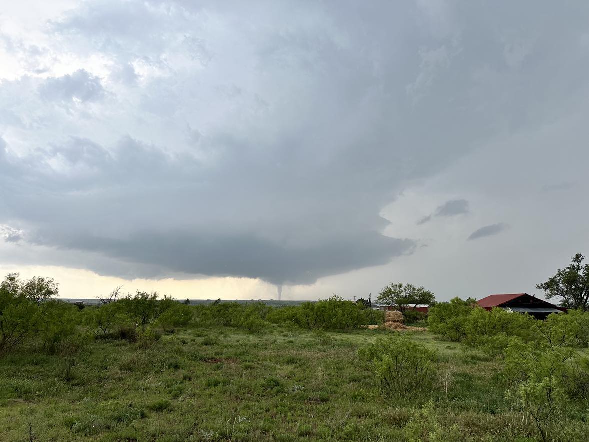
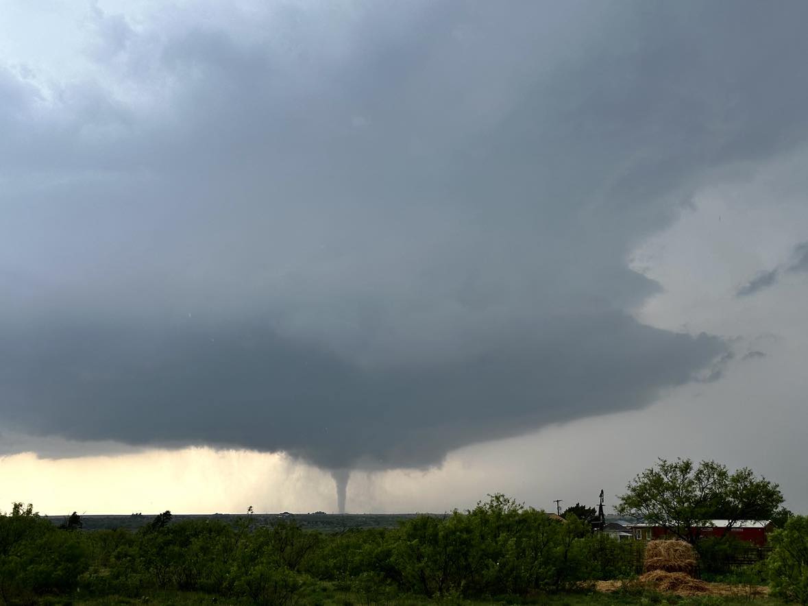
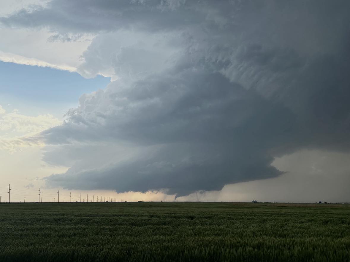
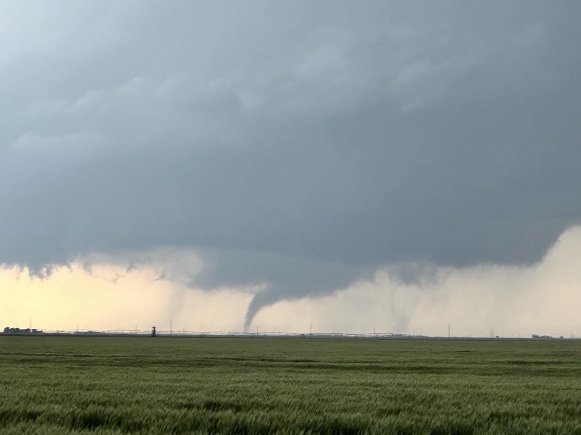
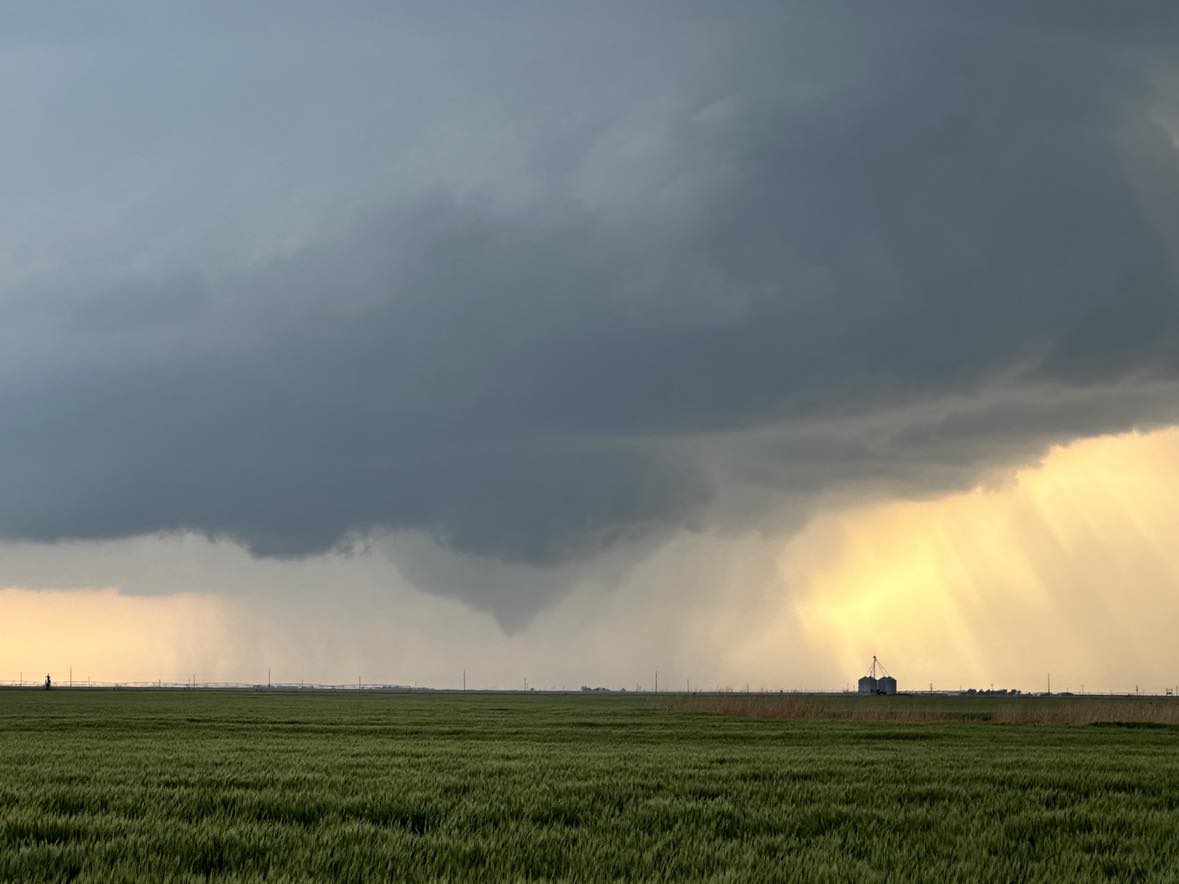
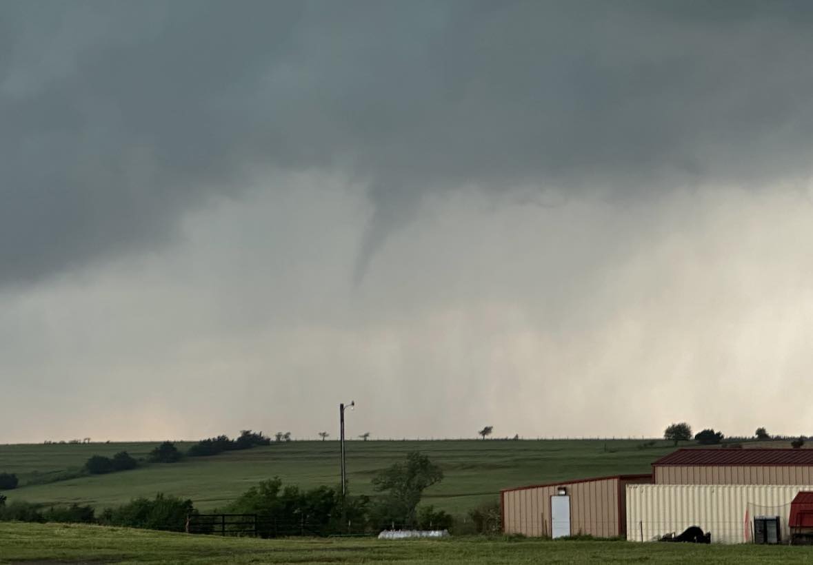
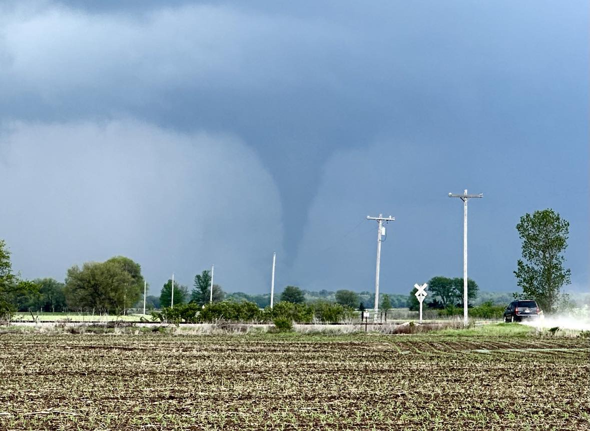
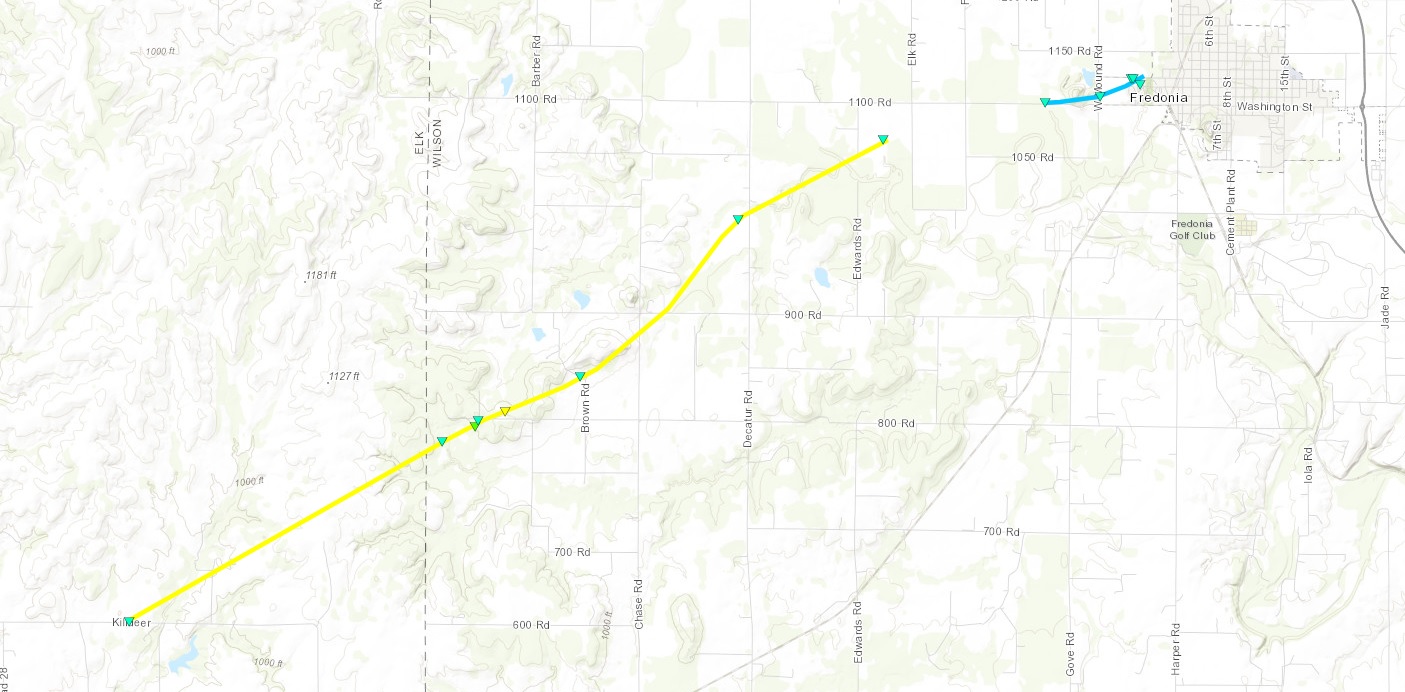
The storm ended up producing a ragged looking weak tornado that tracked along the Alfalfa/Major county line between 6:04 and 6:11 pm CDT:

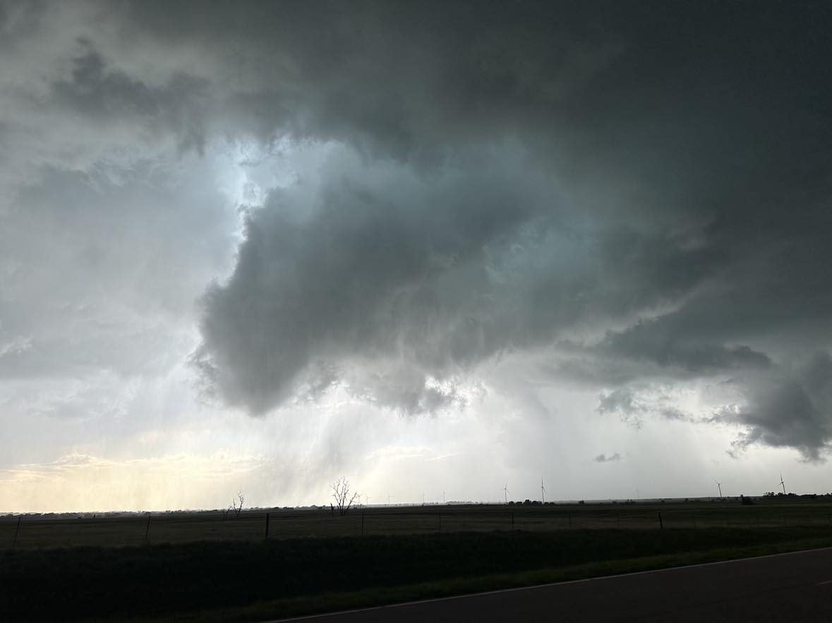
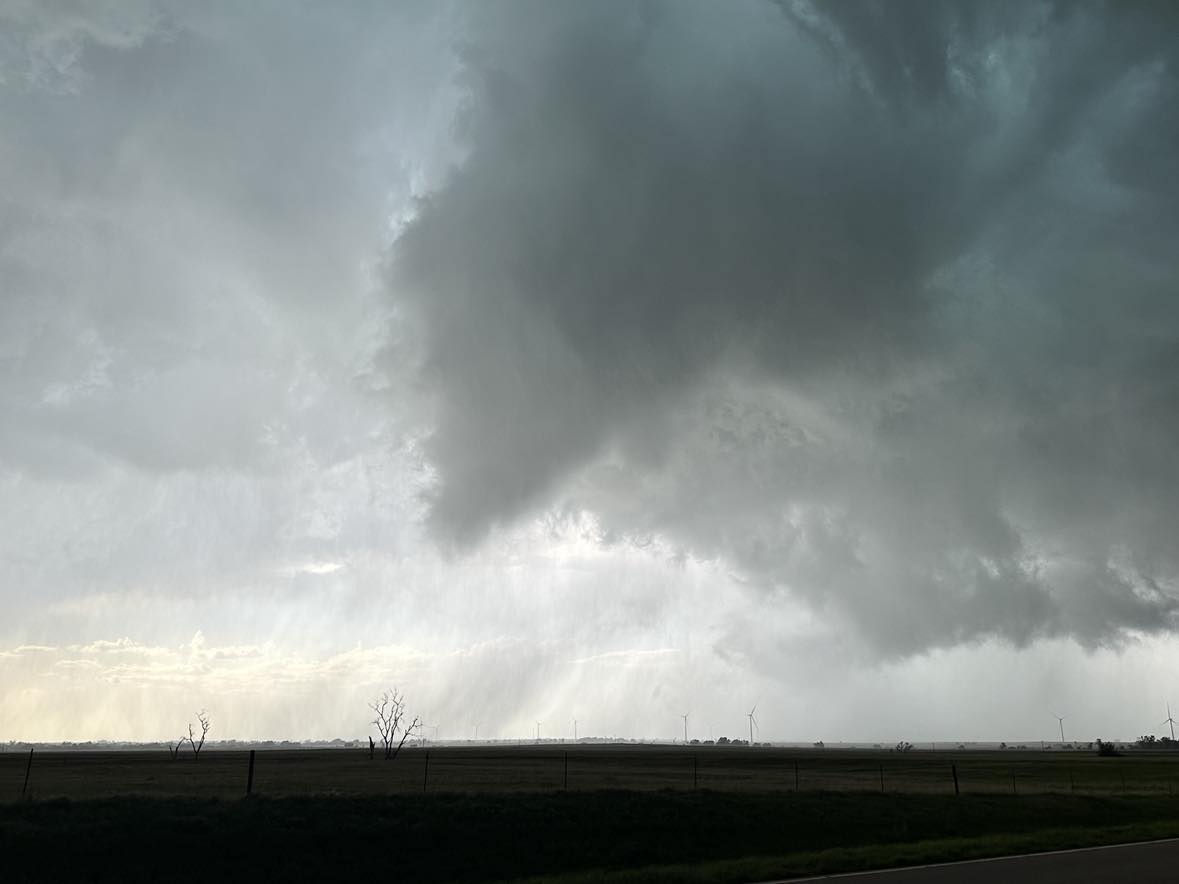
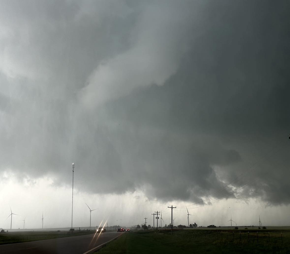
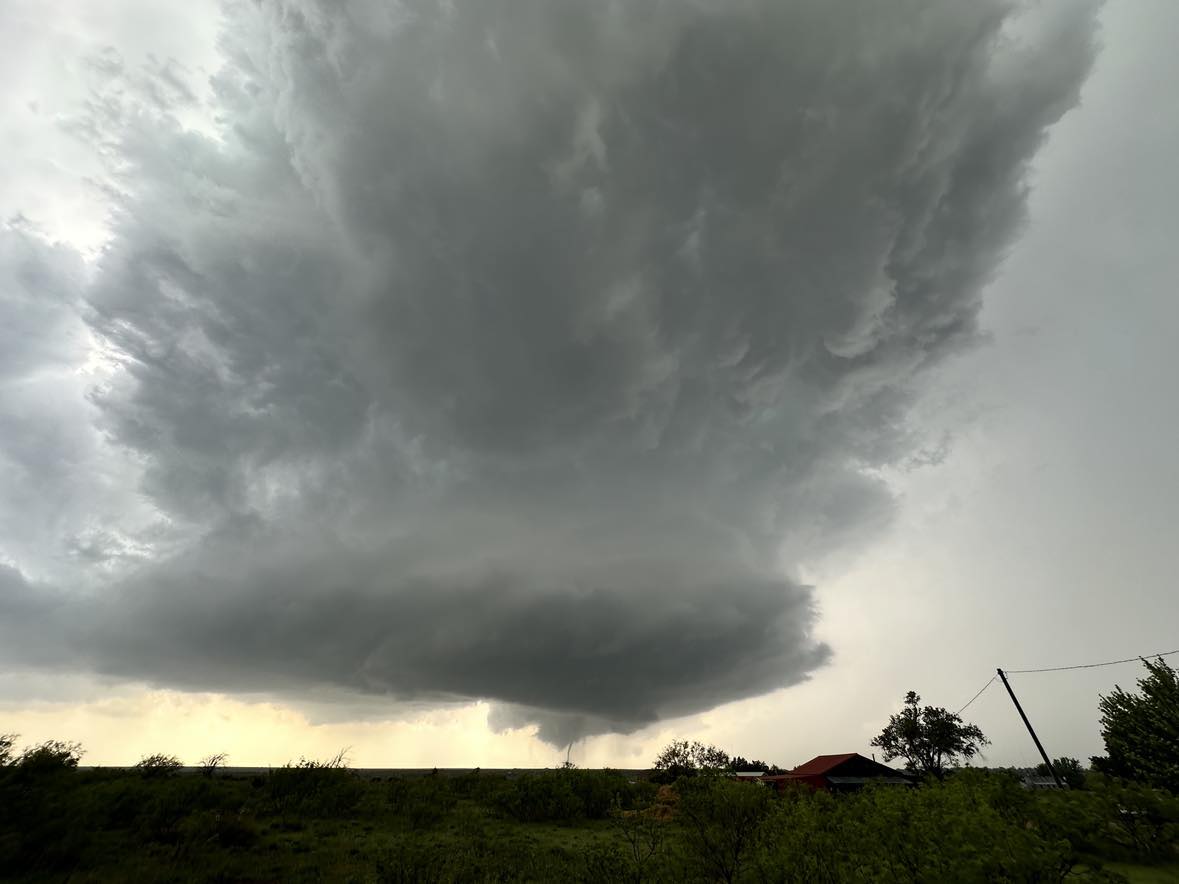
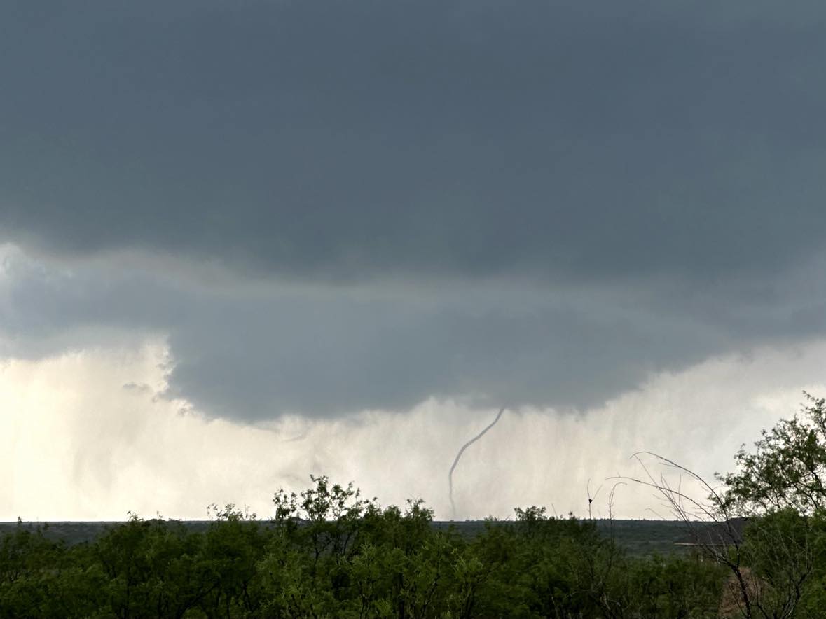
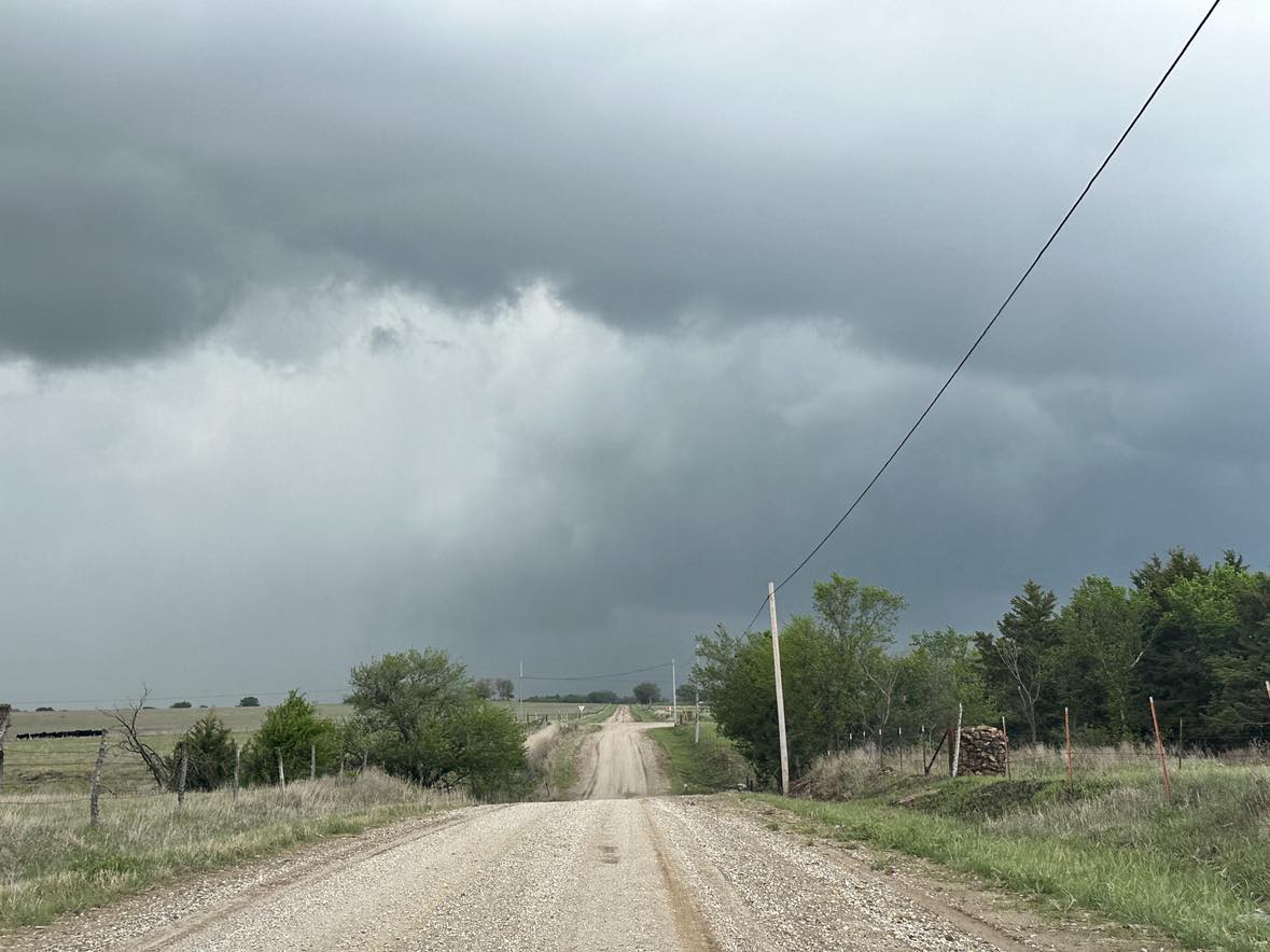
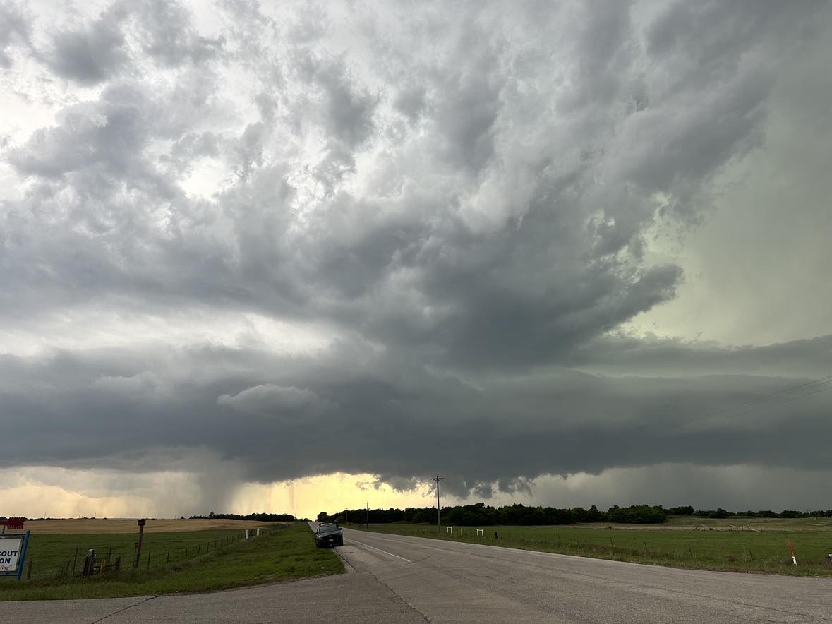
We observed one more high precipitation supercell that moved from northern Kingfisher into southern Garfield County. The storm likely produced at least one tornado, but it was heavily embedded in rain.

Looking west from 6 miles south of Covington at 7:42 pm CDT

1 May 2024 – Eastern Texas Panhandle Tornadoes

It was a nearly text book set up for supercell storms and tornadoes over the eastern Texas Panhandle with good flow aloft, and 70 degree dew point temperatures flowing in on gusty southeast winds. We had just entered the panhandle on I-40 when the first storm developed west of Clarendon.

The first tornado formed and faintly came into view while we were about 17 miles east of it.

Looking west northwest from 3.3 miles west of Hedley at 3:56 pm CDT

The first tornado lasted a couple of minutes and then there was a brief break before the second / longer lasting tornado formed. Both of these tornadoes moved very slow and covered an area only a couple of miles wide and long with a variety of motions – all about 6 miles west southwest of Clarendon. The following photos were shot from the south side of Clarendon.

After the second tornado weakened, outflow from other storms to our south began to impact our target storm and it started to struggle.

Looking northwest from 4 miles east southeast of Clarendon at 4:58 pm CDT

Another supercell had been occurring well to our north / southeast of Spearman. Given the cluttered nature of storms near and southeast of Clarendon, we made the decision to head north toward the Spearman storm. While approaching, a vigorous updraft began to take shape over Spearman. We targeted that storm and observed two small tornadoes in addition to spectacular storm structure. The following images were captured looking west from 12 miles east of Spearman.

Looking north northeast from 20 miles south of Perryton at 8:15 pm CDT.

27 April 2024 – Tornado near Hinton, Oklahoma

It was anticipated that a significant outbreak of severe storms and tornadoes would occur in Oklahoma. Indeed, there were a lot of tornadoes – but mostly after sunset – with the most impressive events near and east of the I-35 corridor. Most of the daylight storm structure wasn’t very sharp and the view complicated by haze. By mid-afternoon, explosive thunderstorm development occurred north of Carnegie.

Looking west from 5 miles north of Carnegie at 3:25 pm CDT

This storm moved quickly northeast and began rotating over northern Caddo County. I observed a brief and weak tornado southwest of Hinton at 4:10 pm CDT:

Looking west southwest from the south side of Hinton at 4:12 pm CDT

The storm went on to produce a rain wrapped tornado in Canadian County to the northwest of Calumet.

26 April 2024 – Southeast Kansas Tornadoes

Deep low pressure tracked from northern Kansas toward western Iowa during the day, and for the first time this season, rich low level moisture was found across the state. The main tornado show on the day was in Nebraska and Iowa, but we did find a small gem over southeast Kansas. Storms began forming near Moline, KS and it didn’t take them long to become severe. Our first encounter with an established supercell was just northeast of Longton:

Looking north from 4.4 miles northeast of Longton at 3:37 pm CDT

We first noticed a ground circulation to our northeast from 2.0 miles west southwest of Buxton at 3:42 pm CDT. A short time later, a condensed tornado appeared:

Looking northeast from 3.3 miles west of Buxton at 3:43 pm CDT
Looking northeast from the west side of Buxton at 3:47 pm CDT

The tornado ended up being rated EF2 as it tracked from Elk into Wilson County.

We observed another brief tornado at 4:22 pm CDT about 5 miles east of Benedict. We also measured hail to 1.86″ and 1.88″ at stops near Moran.