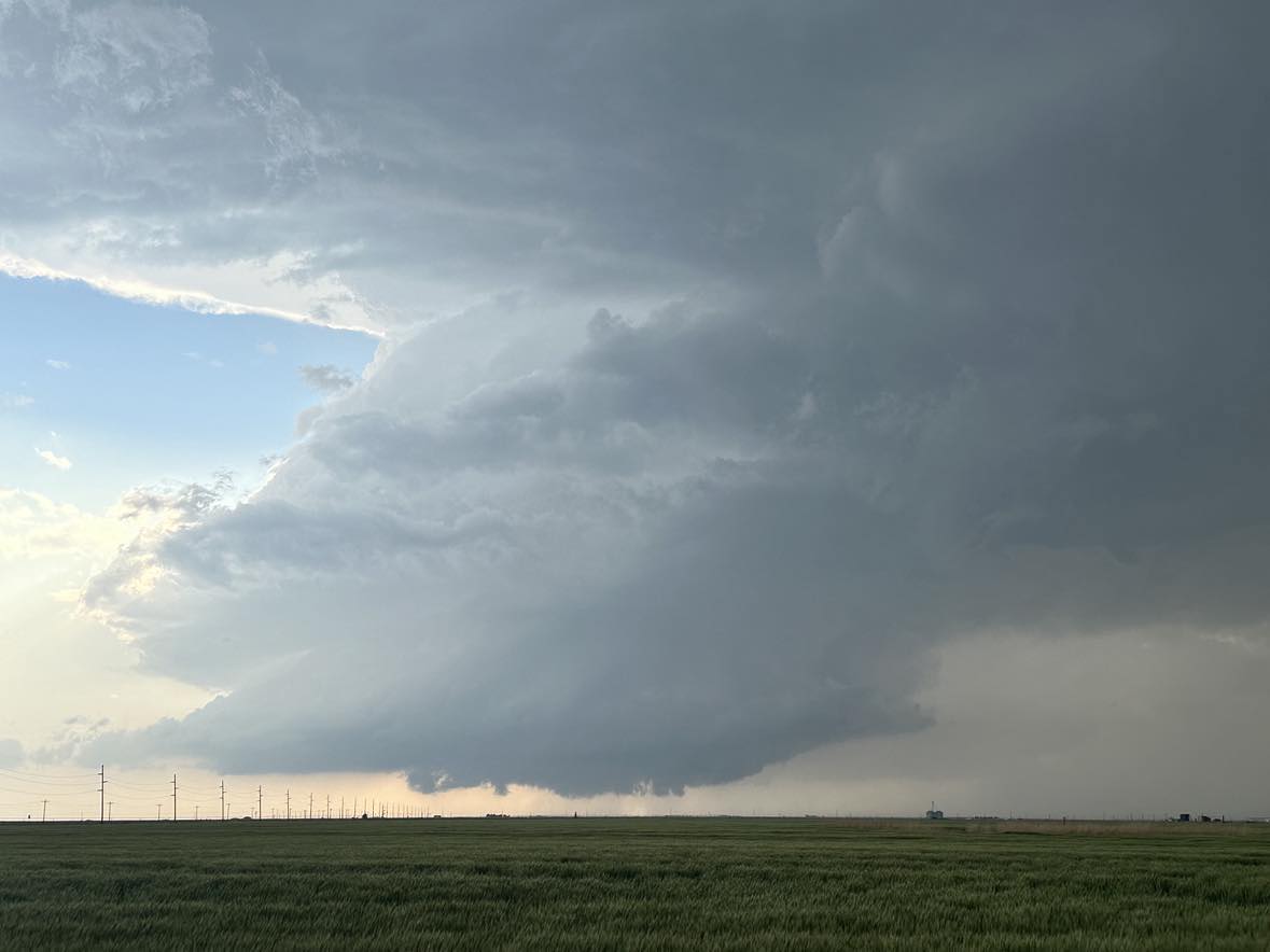
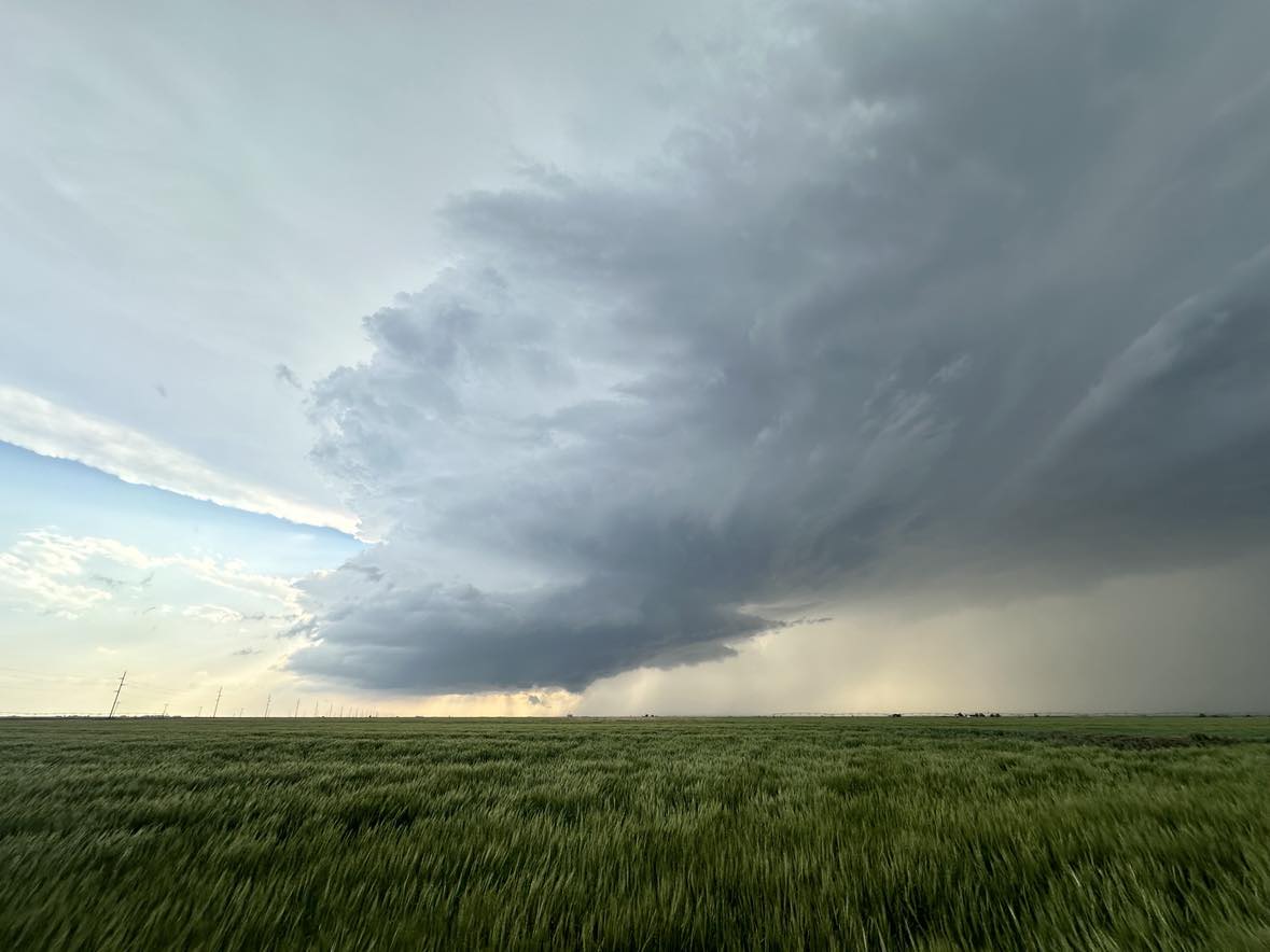
It was a nearly text book set up for supercell storms and tornadoes over the eastern Texas Panhandle with good flow aloft, and 70 degree dew point temperatures flowing in on gusty southeast winds. We had just entered the panhandle on I-40 when the first storm developed west of Clarendon.
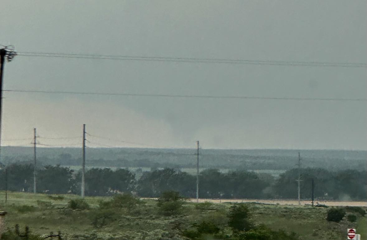
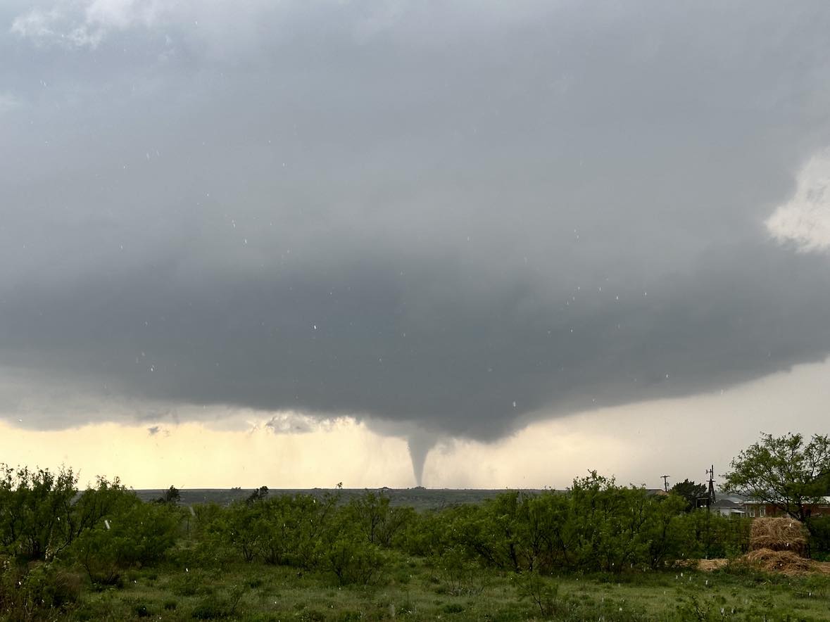
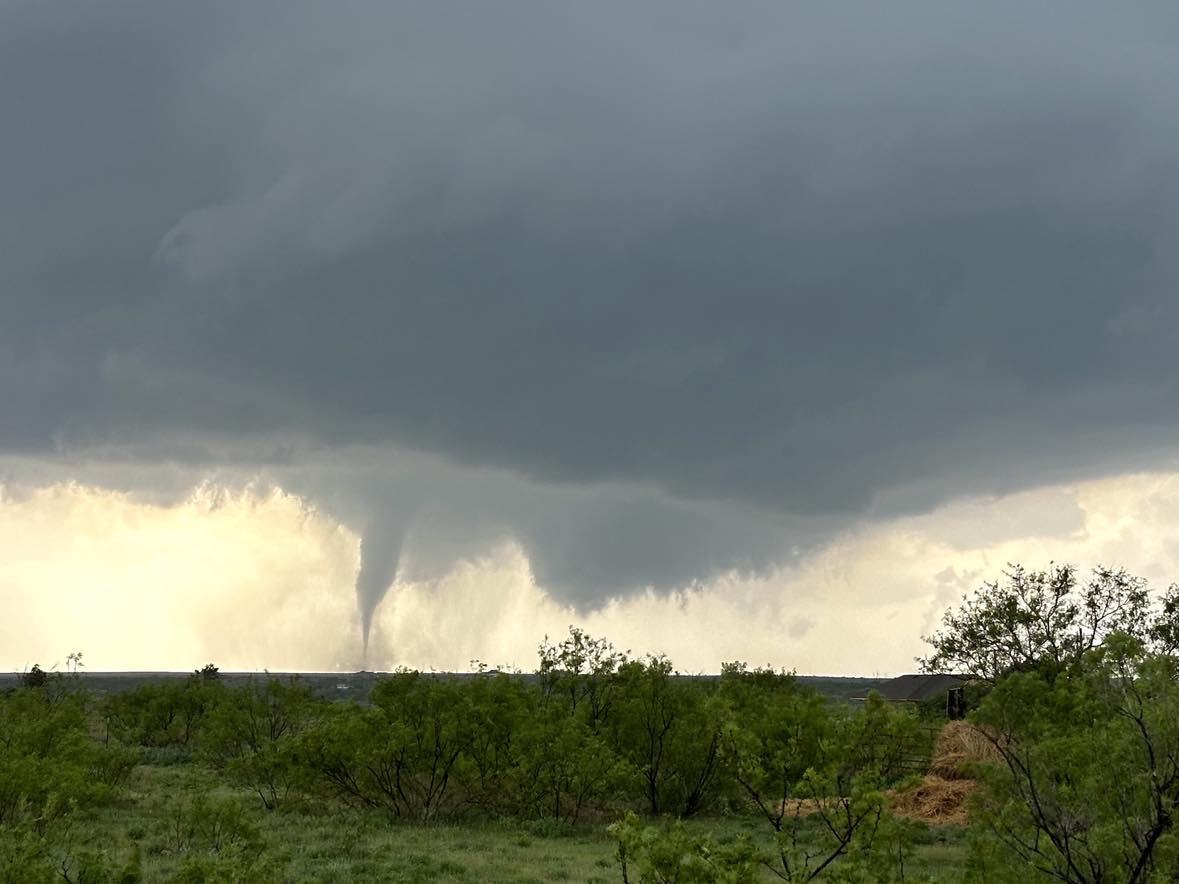
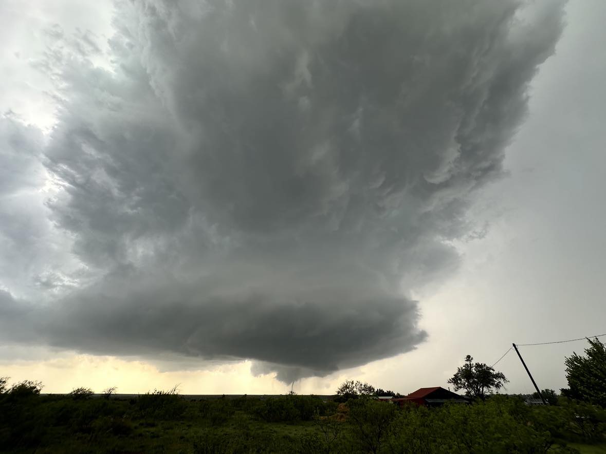
The first tornado formed and faintly came into view while we were about 17 miles east of it.
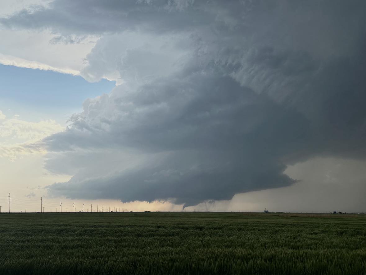
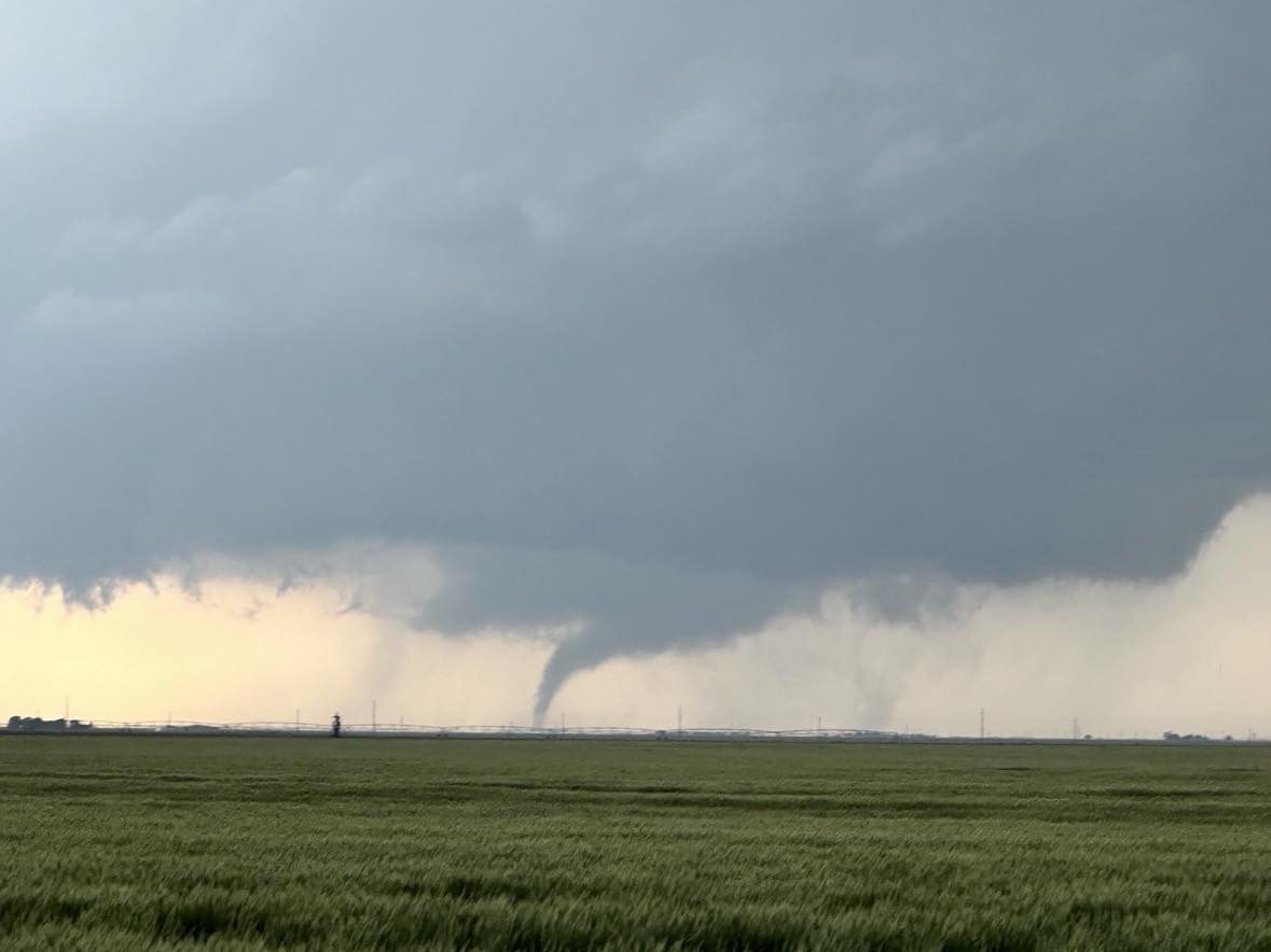
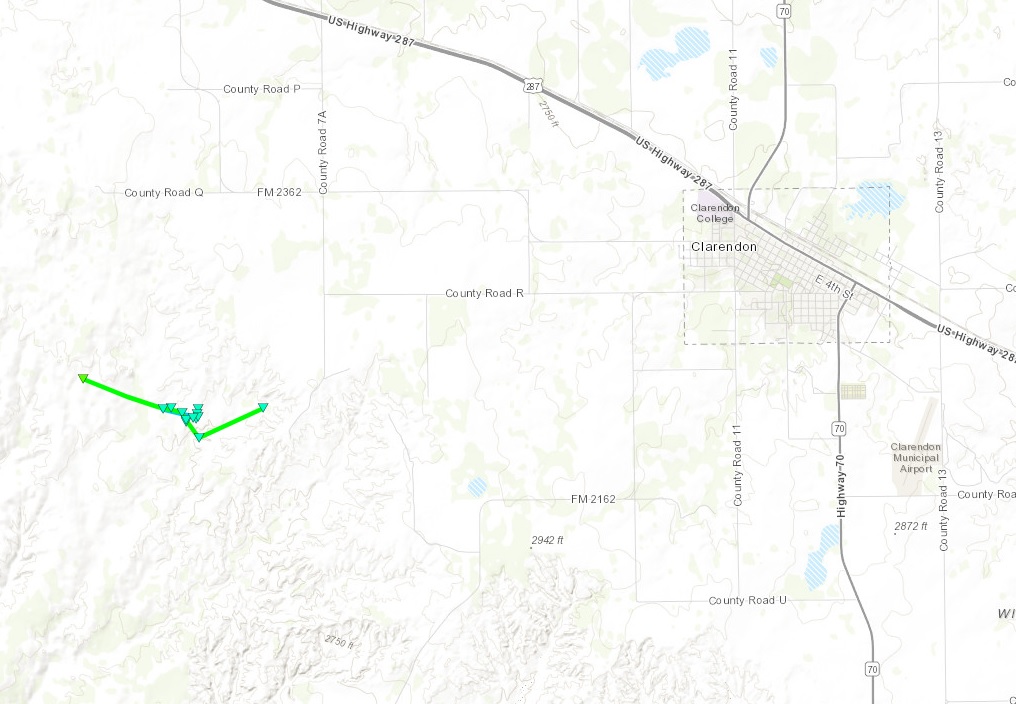
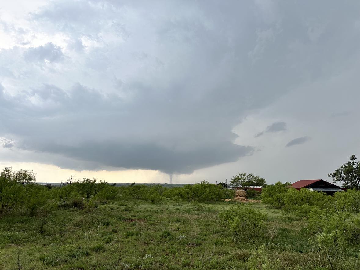
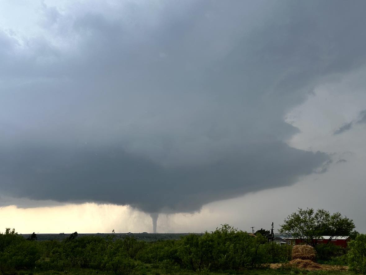
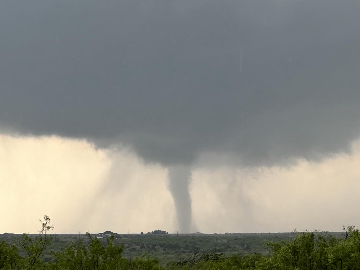
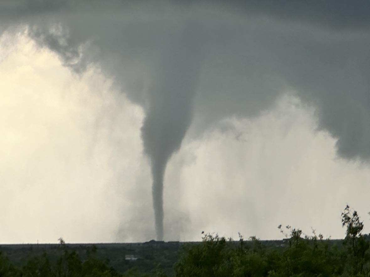
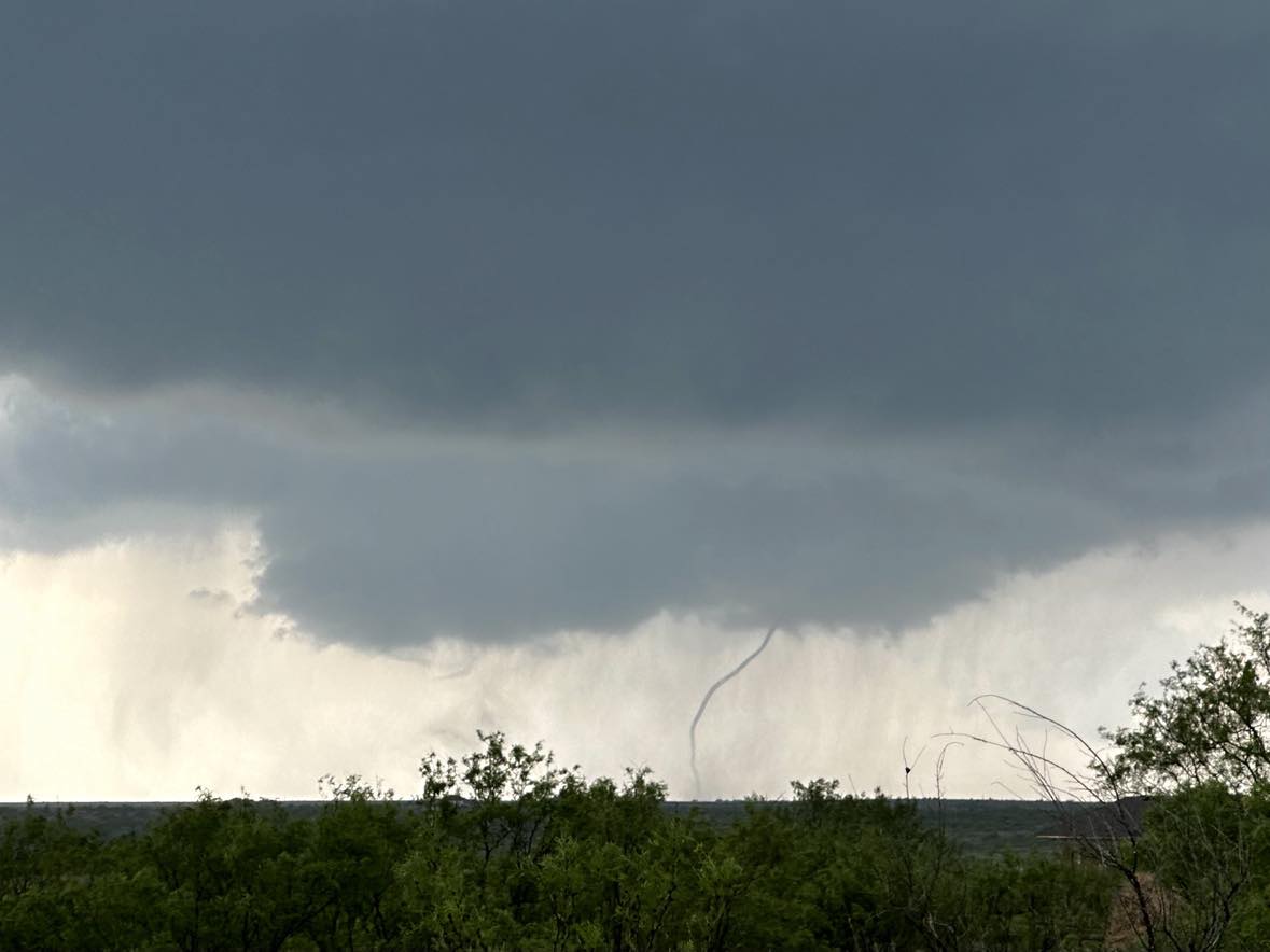
The first tornado lasted a couple of minutes and then there was a brief break before the second / longer lasting tornado formed. Both of these tornadoes moved very slow and covered an area only a couple of miles wide and long with a variety of motions – all about 6 miles west southwest of Clarendon. The following photos were shot from the south side of Clarendon.
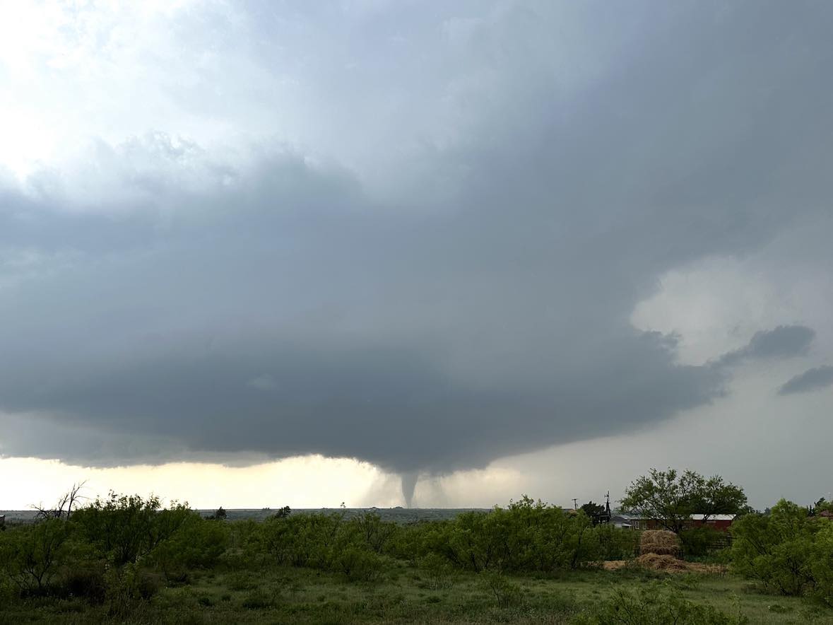
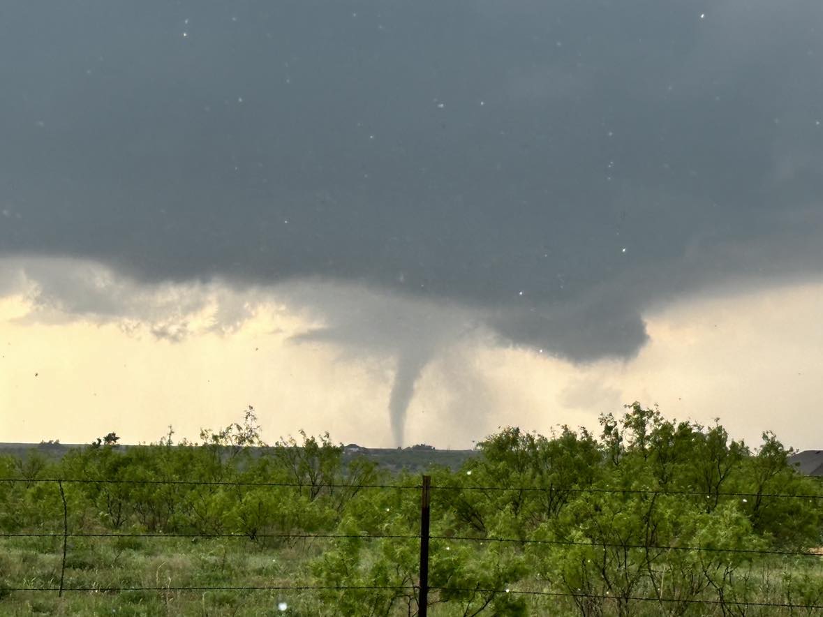
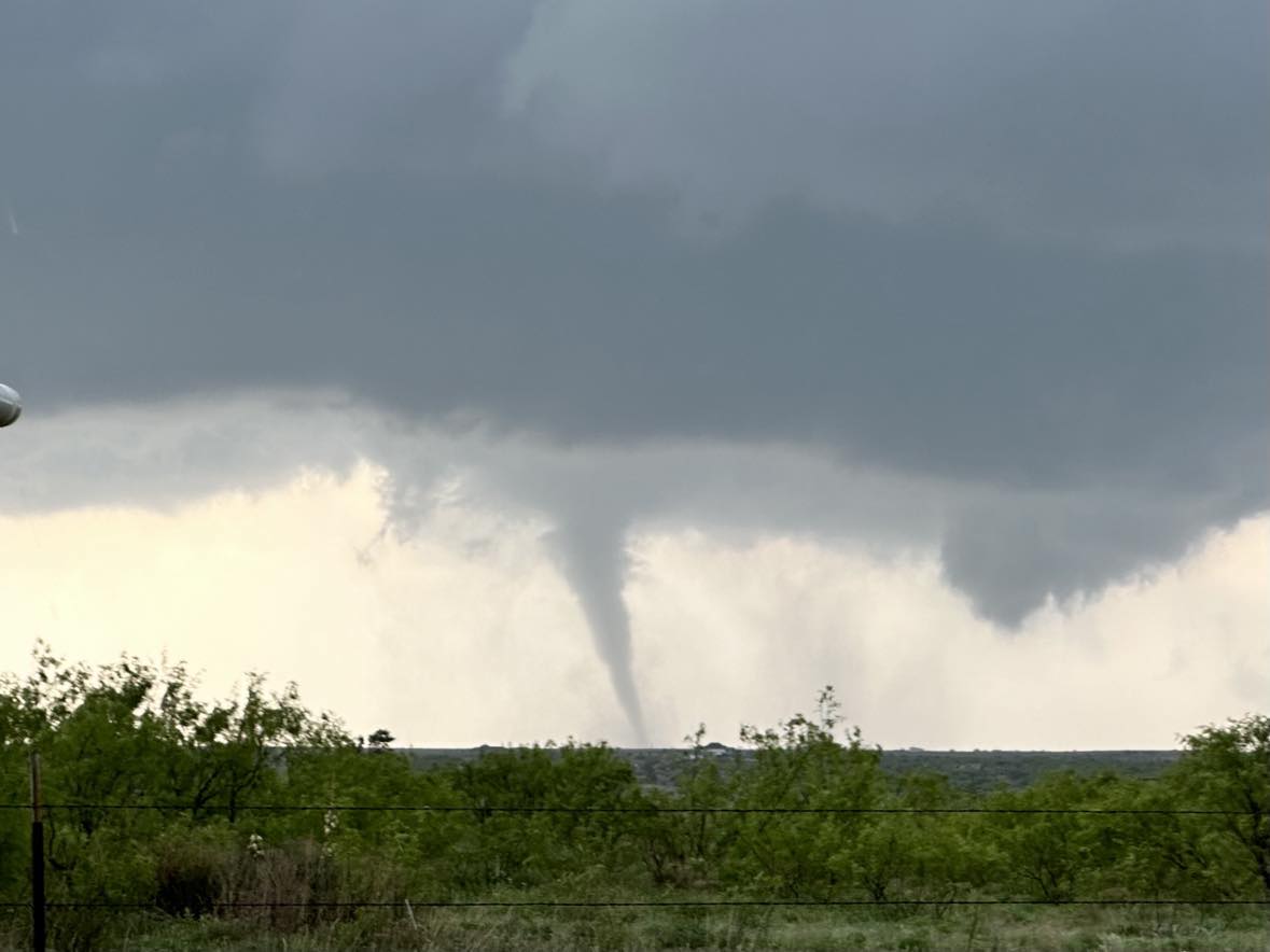
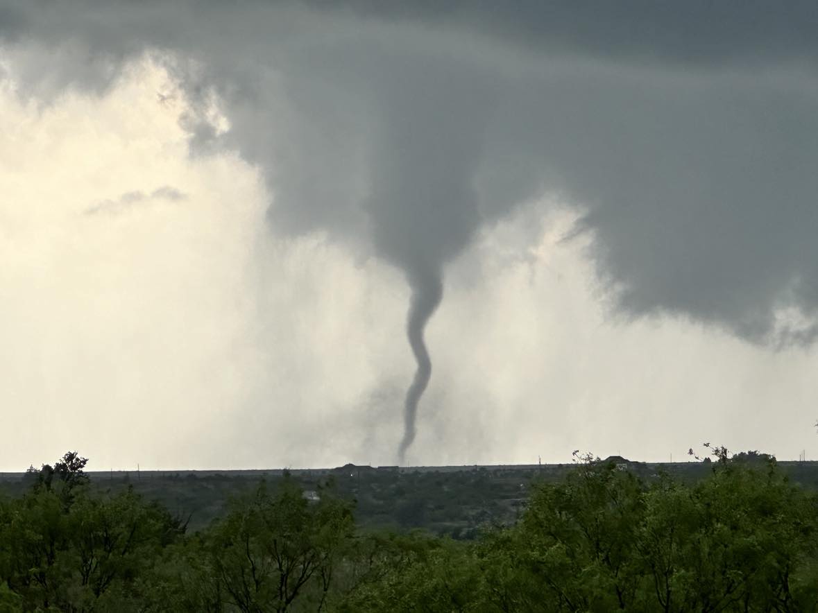
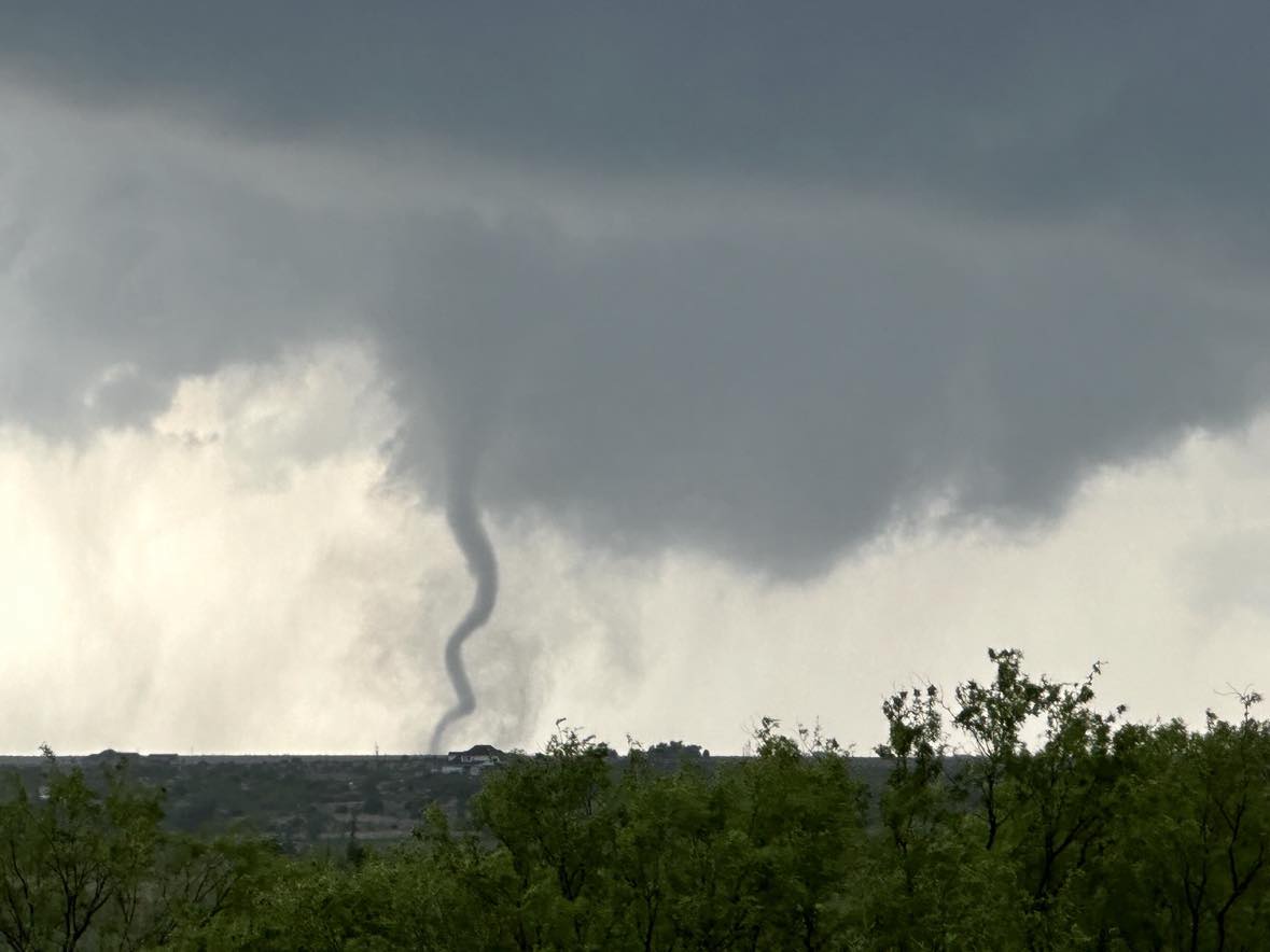
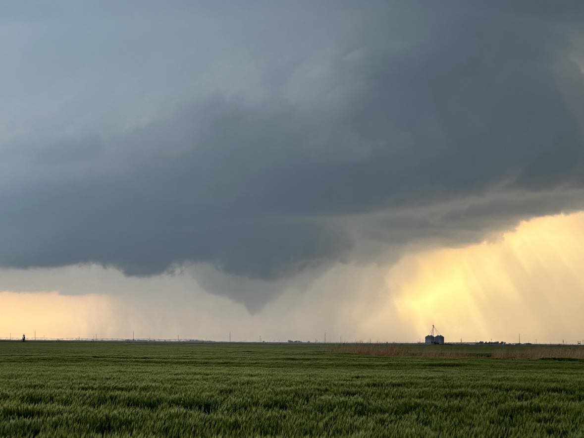
After the second tornado weakened, outflow from other storms to our south began to impact our target storm and it started to struggle.
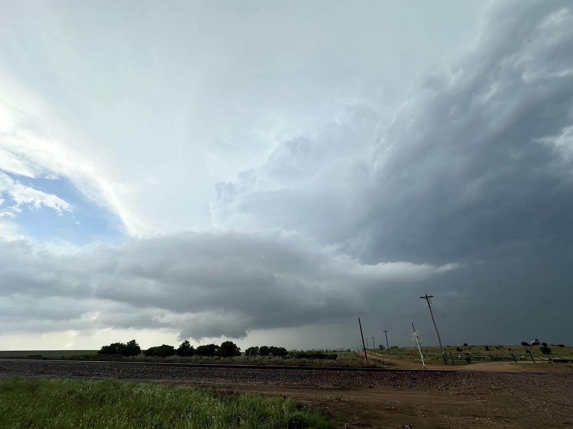
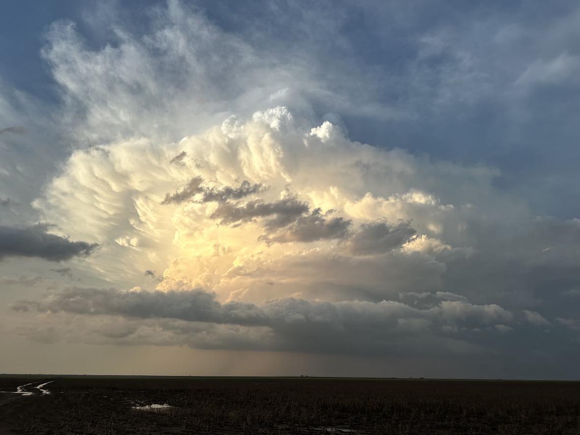
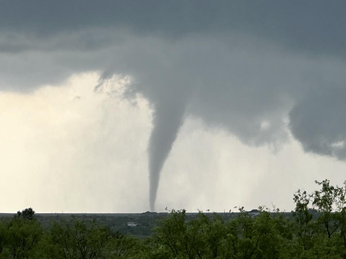
Another supercell had been occurring well to our north / southeast of Spearman. Given the cluttered nature of storms near and southeast of Clarendon, we made the decision to head north toward the Spearman storm. While approaching, a vigorous updraft began to take shape over Spearman. We targeted that storm and observed two small tornadoes in addition to spectacular storm structure. The following images were captured looking west from 12 miles east of Spearman.